We came to Alaska in winter simply for the Aurora Borealis, Northern Lights. However, we leave having done so many more activities and learning so much about this US state. And, btw, Alaska is our favourite place for now. Let’s see if that changes in next 7 months.
Before you get into all the details about our exciting activities, here is a video compilation of all the fun we had. I hope it makes want to come visit Alaska :)
Arctic Circle
Fairbanks is close to the Arctic Circle when you look at the map. But in reality it is 200 miles (320 kms) from Fairbanks. Since we were so close to the circle, we figured that we might as well ride the final ‘few’ miles. When again are we going to be here really!?
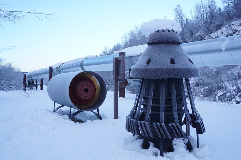
Our guide Randy, from 1st Alaska Outdoor School, met us at the hotel and we realised we were the only ones on the trip. As we headed out, our first stop was the Trans-Alaskan Pipeline. This pipeline runs for 800 miles (1,287 kms), almost through the height of Alaska, from Prudhoe Bay to Valdez, port at Gulf of Alaska. It is the backbone of Alaskan economy as it provide jobs and financial benefits to all Alaskans in form of at least $2k cheque every year.
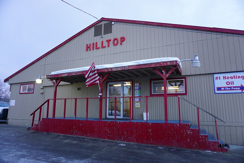
Our next stop was Hilltop Truck Stop, on Elliott Highway. It is the last place to get food, essentials and petrol for 500 miles. It is also famous as the first stop in the show Ice Road Truckers.
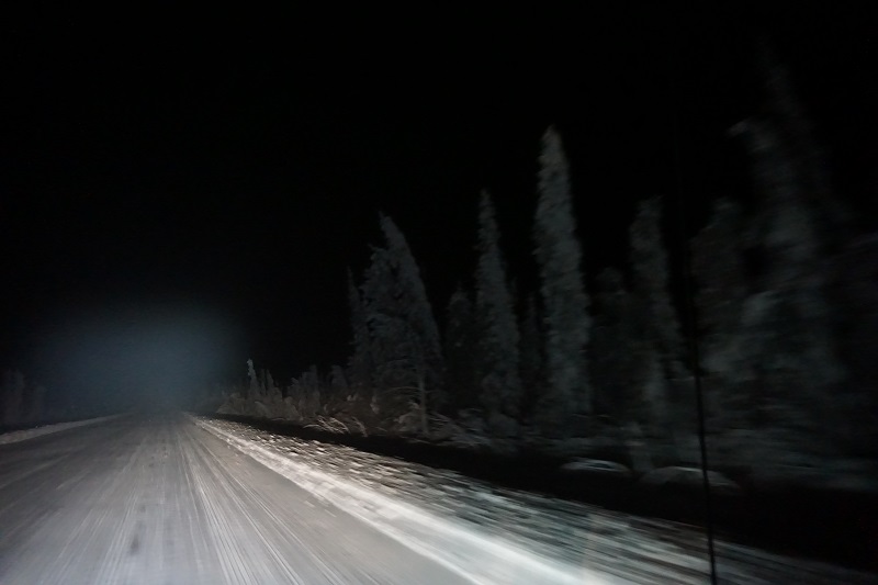
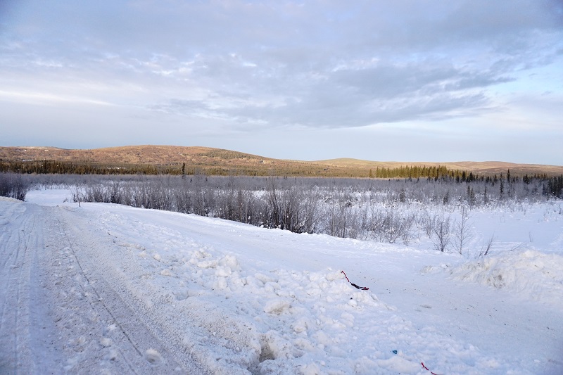
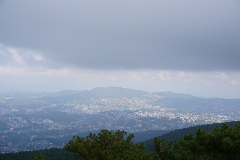
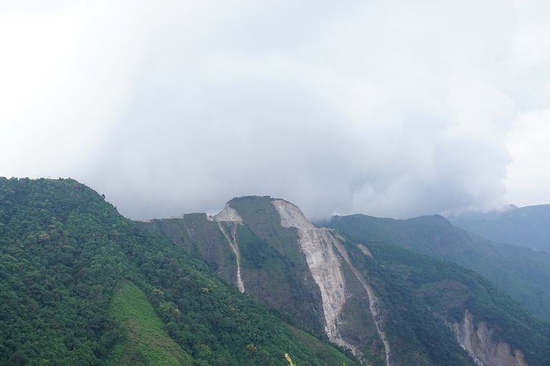
While most of our journey was on the Elliott and Dalton Highways, we rode on mountain roads with very few flat stretches. Along the way, we stopped at Winchester Dome to stretch our legs and take couple of photos. While there, we saw some real mushers training the dogs while their kids helped around. The dogs were cute, the mushers were busy and it was absolutely freezing. We wanted to pat the dogs but decided against it as they are working dogs.
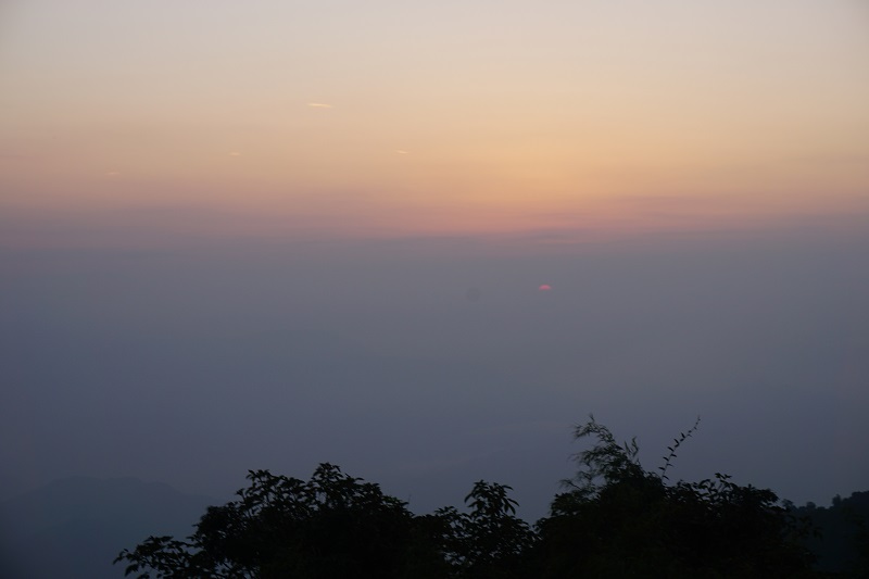
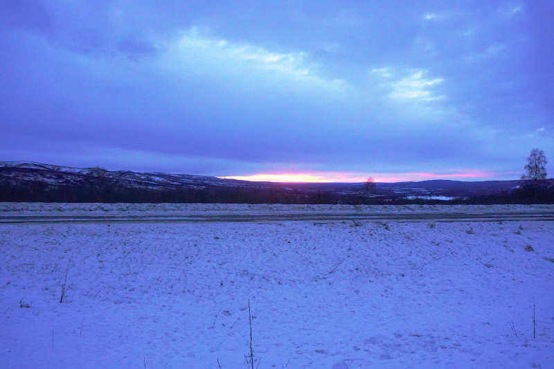
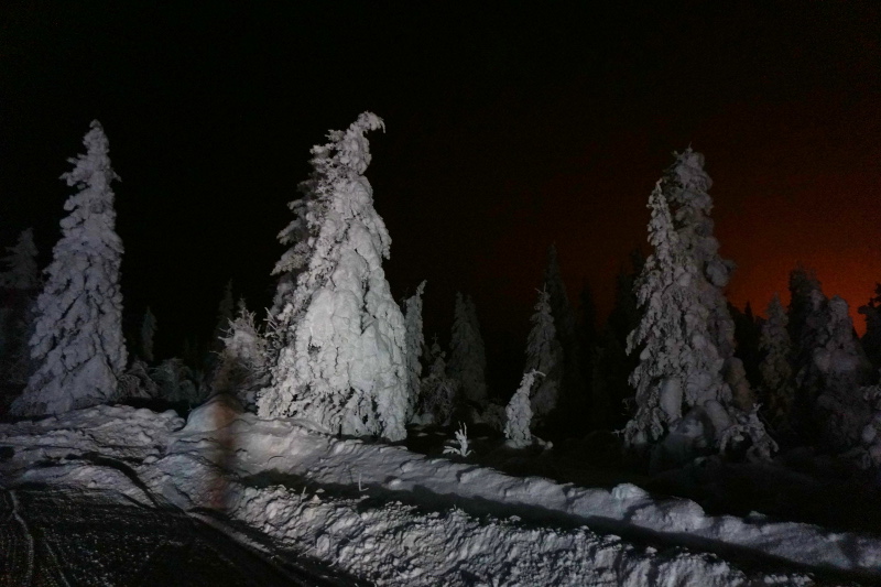
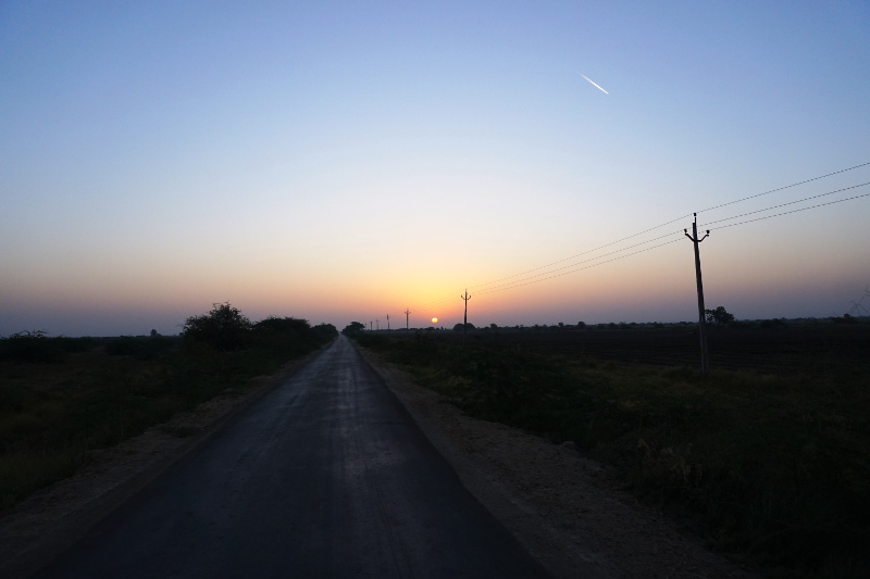
As we jumped back in the car, we realised the sun was ready to go down. We informed Randy about wanting to take pictures and he drove a few miles down the road to his secret spot for sunset shots. Truly, the spot was amazing and we couldn’t have got a better sunset. The landscape of the area was stunning with mountains and snow everywhere. We found some good pack snow and decided to make snow angels (see video above or on YouTube).
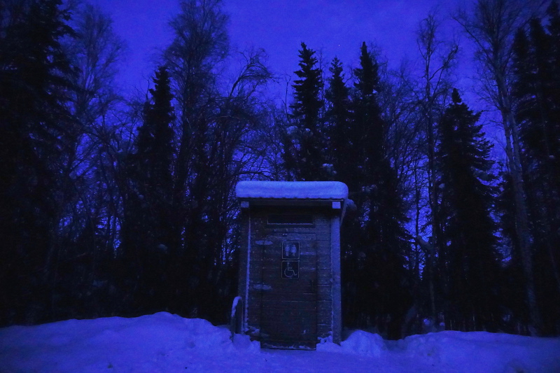
We didn’t stop until Colorado Creek for a bathroom break. The creek was completely frozen and the outhouse was disgusting. At this stage, Randy informed us that wilderness starts once you are 20 or so miles out of Fairbanks. After this it was only truckers, trappers and tourists. We did not see any other cars or people except truckers for the next 150 miles.
The game changed completely once we hit the Dalton Highway. Dalton Highway is not a state road, but privately owned. It was built only to supply Prudhoe Bay and other sites along the pipeline. At the start, Randy had to turn on his short wave radio and alert the truckers where he was. It felt like we were trespassing on a private road.
As we went further and further, we realised why they made a TV show out of this road. The road is literally ice for large parts. The trucks drive at 70 miles per hour on this ice road and mostly they drive in the middle. The two way radio was mainly to alert them that we were sharing their road.
Along this road, we saw the ghost trees which are hit by snow winds almost all year so they are completely white. They truly are a sight. One may confuse them to be dinosaur skeleton!
We also went over the Finger Mountain and Beaver Slide. Both these places have gale force winds and beaver slide is aptly named as trucks regularly slide off the road. At this point, we were incredibly scared. If the trucks didn’t kill us, the gale force winds might bow us off the road.
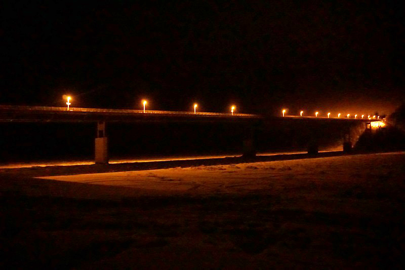
Further down, we saw a frozen Yukon River and the Yukon Bridge. It is the only bridge on the mighty Yukon River in Alaska.
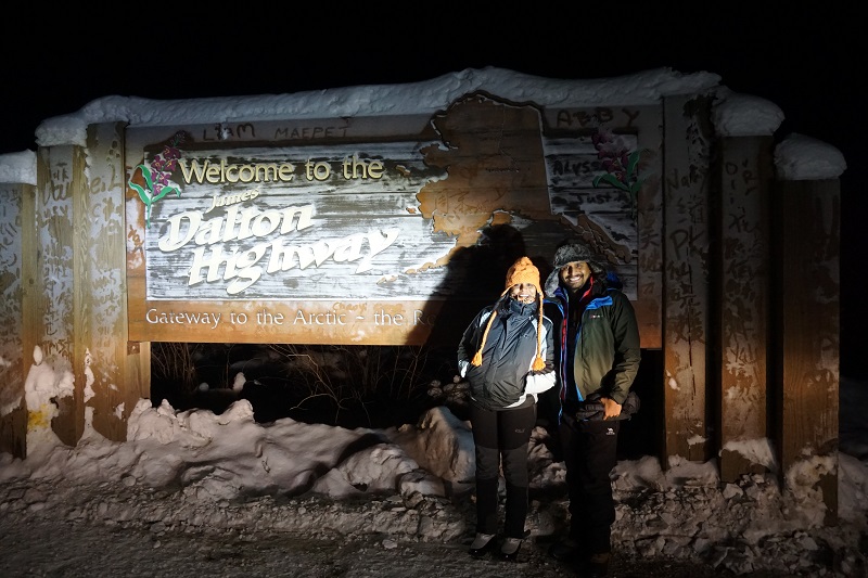
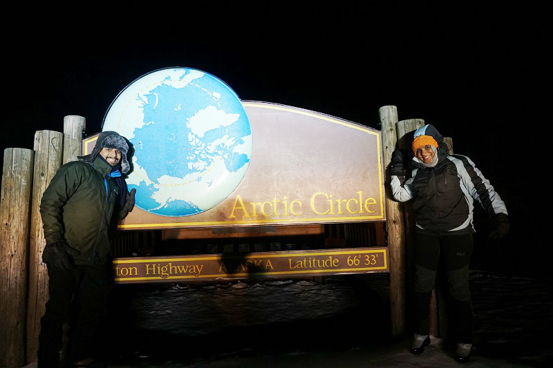
Finally, after driving for almost 8-9 hours, we made it to the Arctic Circle. You know how they say the journey is more important than the destination, well, we certainly find this to be true at the Arctic Circle. There’s nothing there really. A campsite, a bill board, a toilet, pitch black darkness and the boreal forest is all there is. However, it felt like an achievement simply because of the roads we had passed. We made it to a place where few will ever go in their lives. It has to mean something!
The return journey was uneventful for the most part. We briefly saw the Aurora as we left the Arctic Circle and then went through a wind storm, a snow storm and ice fog for 120 miles. At Winchester Dome, the sky was clear again and we saw the aurora again. Seeing the aurora move overhead is a very deep and humbling experience. It puts your life and problems into perspective for sure.
Dog Sledding
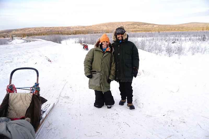
Another unique thing about Alaska and the Arctic is the use of dogs for travel. The word used out here is “mushing” and the people in the business are “mushers”. The word itself comes from the French March, which sounds like mush in English. We took a trip out with Ben for it and drove about 4 miles outside the city. As we arrived, the mushers’ cars were parked on the road but they and the dogs were missing.
While we were waiting around, we heard the dogs bard and knew the mushers were arriving soon. Now, it was our turn! We put on some oversize jackets and pants and got a quick tutorial on dog sledding.
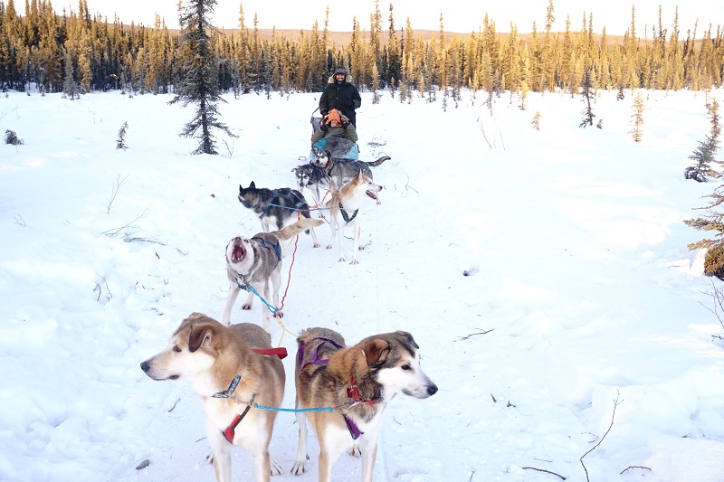
For the first 15 minutes, Shruti sat in the sled while I was standing and we reversed the next 15 minutes. Our guide, Zach, with only a few layers of warm clothes was on the main sled at the back. There wasn’t much to learn except that if the dogs turn too fast around a corner and the sled is about to flip, don’t try to break your fall with your arm. Doing so will almost certainly break it so just go into a fetal position.
With that much needed instruction, we were on our way. The dogs were anxious, they are born to run and know little else. The sled glides through the snow at a rapid pace with 7 dogs running. Every couple of minutes, Zach put the breaks on and let the dogs rest. It was too hot for them at a warm -9 degrees! The first thing they would do is to eat snow to keep cool. Zach would yell a few words of praises and encouragement for the huskies and they kept running.
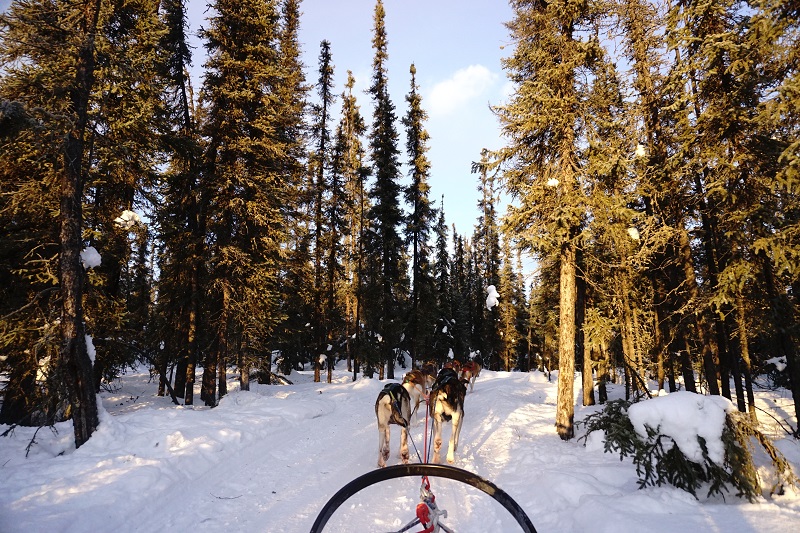
While the dogs and Zach felt warm, Shruti and I were slightly cold in the hands and feet but loving the teamwork of man, dog and nature. We had our teamwork going on as well. Shruti clicked pictures while I took timelapse video in the saddle. It was the perfect time of the day and the sun shined on the flat snow and the boreal forest, turning everything golden. It wasn’t the best for the dogs but Zach gave us extra 10 minutes on the sled. Perfect end to a perfect ride!
Chena Hot Springs
On our second last day, we decided that we should warm ourselves a little bit in the hot springs nearby. Ben, Alaska Northern Lights Tour, did an entire package deal and we went for it. He drove us to Chena Hot Springs Resort, which is 56 miles (90 kms) away from Fairbanks. When on the road, we were glad we didn’t drive ourselves because most part of the road was covered in ice.
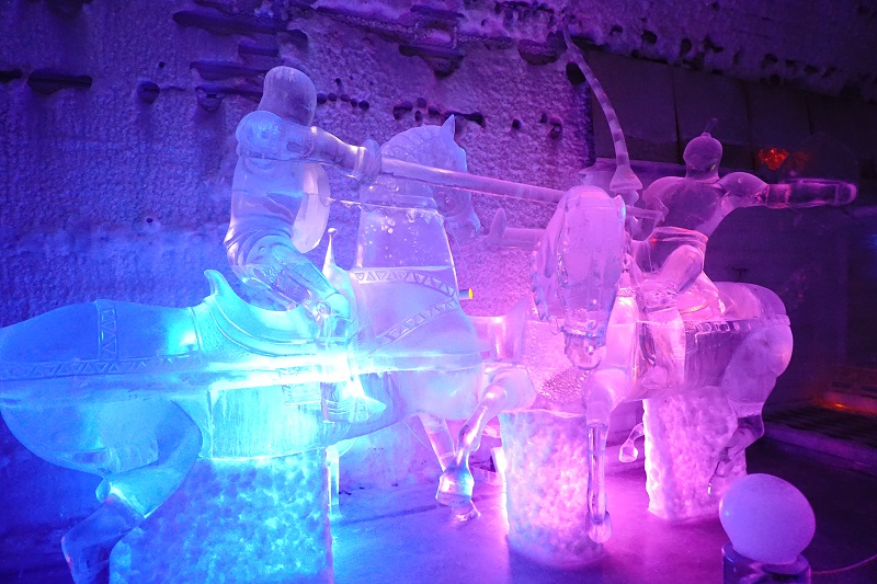
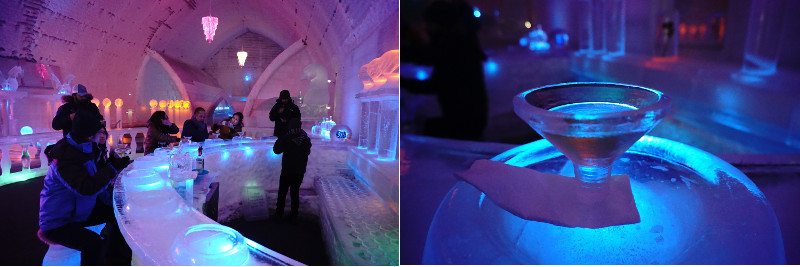
Once we got to the resort, Ben told us about all the activities we will be doing. We started our tour by visiting the ice museum. The artwork was delicate and cold.
We spent about 45 mins there and enjoyed appletinis in ice glasses, sitting on ice stool at the ice bar. That was really cool, literally!
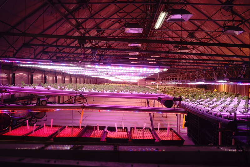
Once done with museum, we headed for a geo thermal tour. Basically everything in Alaska is about sustaining themselves. The resort have two water generators that produce electricity for the resort. Additionally they have few greenhouses as well where they grow their own lettuce, tomatoes and often herbs too.
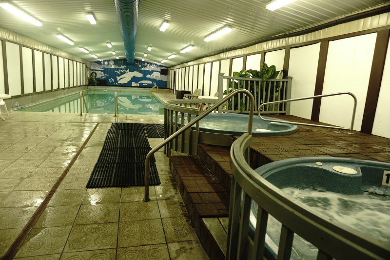
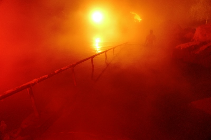
The best was left till the end thanks to Ben’s organised tour. It was finally time to check out the hot springs! We changed into swim wear and chilled in the warm jacuzzi before heading out to the hot springs. It is important to know that the distance to the hot springs is about 20 steps, but as soon as you open the door to step out, you are greeted with cold wind.
Also, I have to mention that the outdoor hot springs pool was pitch dark, with red and green led lights at various spots that created a soothing mood and steam everywhere. If it wasn’t for the hot springs, it could have been the set for a bad porn film.
We put our towels on the hanger and ran out into the water. It was an unreal feeling going from -10 degrees to 30-40 degree water. At that point, the water felt like your best friend. We swam around for a bit and the water got hotter. The funny thing was, our face and hair was getting cold while the body was hot. In fact, if I kept my wet hair unattended for 15 mins, I am sure the water in my hair would freeze to ice!
After half an hour, we had had enough and moved inside. It was so relaxing that we could have stayed longer but that hot water especially with the sulfur is not great for a long time. We showered and got ready to leave with our eyes half closed.
Outdoor swimming in Alaska, in middle of winter – Done!
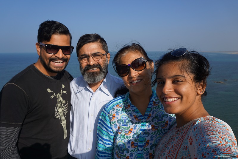
Shruti’s dad has had several postings around Western India due to his job in the Department of Shipping. The in-laws were posted near Kandla, Gujarat this year and we were keen to see this area while they are here.
We got the opportunity later in our travels in India. However, one could say that in some ways we left the best to last!
Land of textiles
Gandhidham where Shruti’s parents currently are is in the Kutch area of Gujarat. It has its own language, culture and unique geography. On our trip to Bhuj, the city that was devastated in 2001 due to the massive earthquake, we noticed the colors of the clothing of women in the area. They ranged from bright green to red and even darker colors like brown and black. Interestingly, the colors they wore depended on the caste, age and marital status of the women.
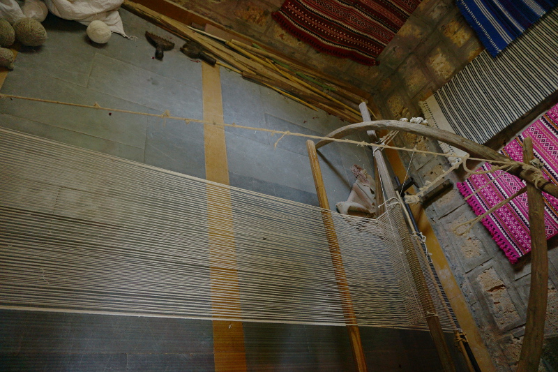
Shruti’s mum and Shruti got down to buying some local clothes. We also visited Bhujodi village, which is basically a craftmen’s village where the traditional people of the region created cloth, paintings and accessories. It was a great effort by the local govt to keep traditions alive!
We saw more of the textiles and culture in the Bhuj museum. For a town that was nearly flattened 14 years ago, Bhuj has transformed itself into a textile centre and a gateway to Rann of Kutch. It was only the beginning of getting to know about it.
Road trip
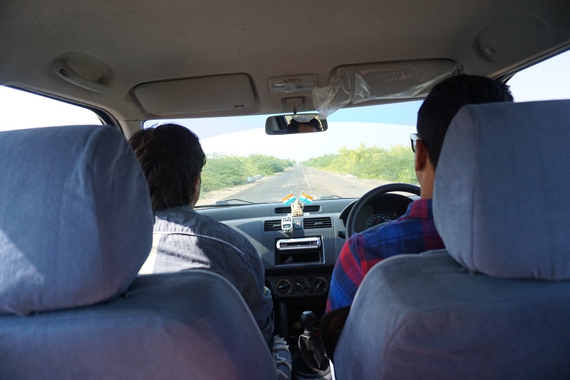
Other than Kutch, Gujarat is famous for its temples. Our driver, Jaisukhbhai (in Gujarat, all males are addressed as bhai, which means brother, and all women add ben, means sister, after their first name) drove all of us from Gandhidham to Jamnagar and then to Dwarka, 150km away.
Dwarka area was the Hindu God Krishna’s capital which apparently now lies under the sea due to the sea levels rising and earthquakes in the region (nature doesn’t even spare the Gods!).
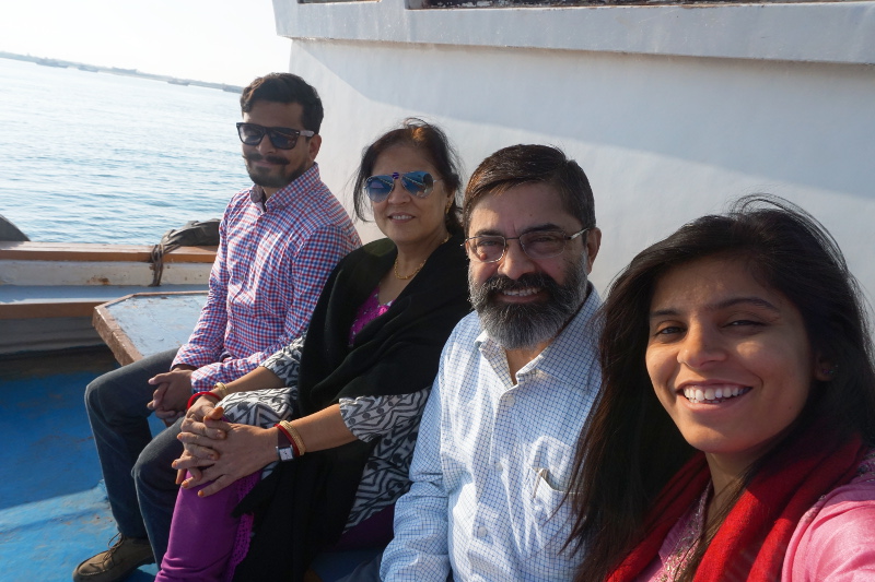
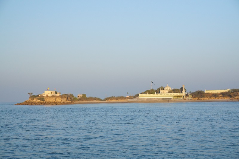
We visited Bet Dwarka or Dwarka Island which houses an ancient temple. It is a beautiful boat ride away from the mainland and the island has the population of Hindus and Muslims. Somehow they all live in peace and the sea is amazingly clean which is strange for an Indian port.
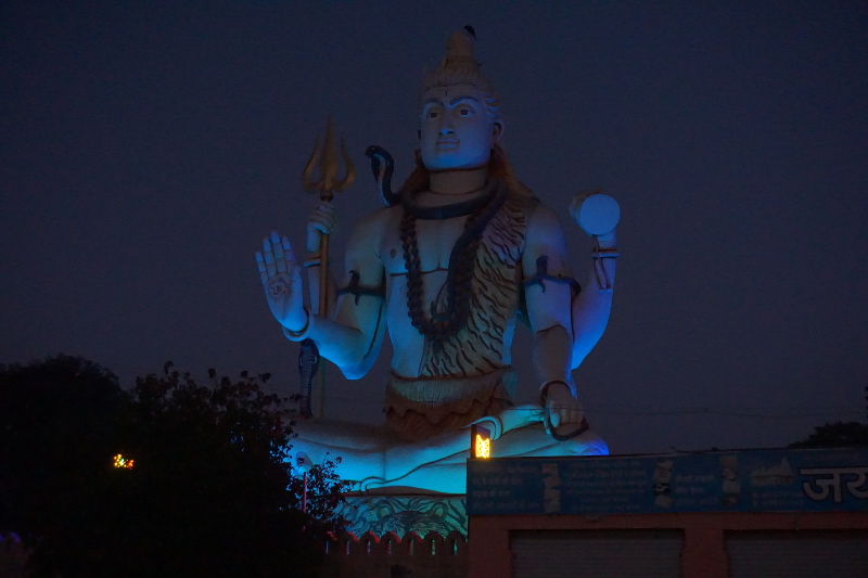
Our next stop was Nageshwar Temple which is one of the 12 Jyotirling, power centers of Shaivite Hinduism. The temple itself was quiet and peaceful, though the highlight was a huge Shiva statue with live peacocks sitting on top. Nag in Sanskrit means Cobra and on a certain festival, a male and a female cobras are brought to the temple. Sad that we couldn’t see a Cobra party!
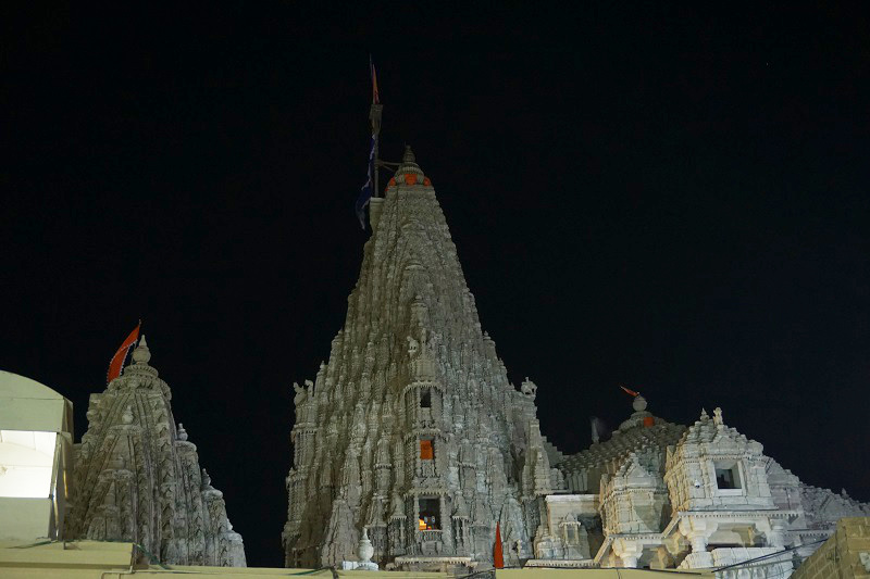
Finally, we reached the main Dwarkadhish (Lord of Dwarka) temple, which is built next to the sea. The building itself was carved in sandstone and built in 16th century. However, the original temple at this spot is dated around 2000 years old. The carvings on the temple are beautiful but nature spares no one and the salty breeze is slowly damaging the temple. There was a huge crowd near the idol which unlike other Krishna idols, is adorned with jewellery. A king needs his bling after all!
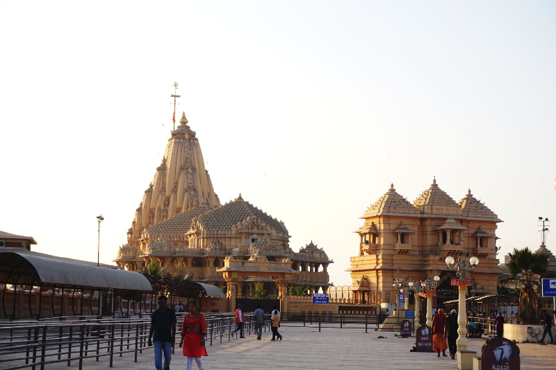
The next day we drove for a long distance and reached the Somnath Temple. This temple is one of the biggest jyotirling temples in India. Moreover, no other temple has felt the wrath of Islamic invasions like this one. Somnath was looted and destroyed many times over the years by Afghan invaders. It was rebuilt by the efforts of Sardar Patel after Indian independence. It is an amazing view from the coast seeing this beautiful temple. However, this temple is also high on the hit list of terrorists for historic reasons and the security is very tight. It was so tight that males are not allowed to wear belts even if the belts are not made of leather (cows are sacred and belts may have bovine leather).
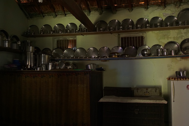
While on the way home from Gir Forest, we had a chance to visit Jaisukhbhai’s maternal village. We met his aunt, cousin and cousin’s wife who all talked to us in Gujarati and we could only do the universal nod as we didn’t understand a thing they spoke! However, their house was the old style village house with an open area, a storage room, huge kitchen and shaded areas to escape from the sun. I was served water in a steel pot, instead of a glass, and I had to drink water from it and pass it on. It was a different experience.
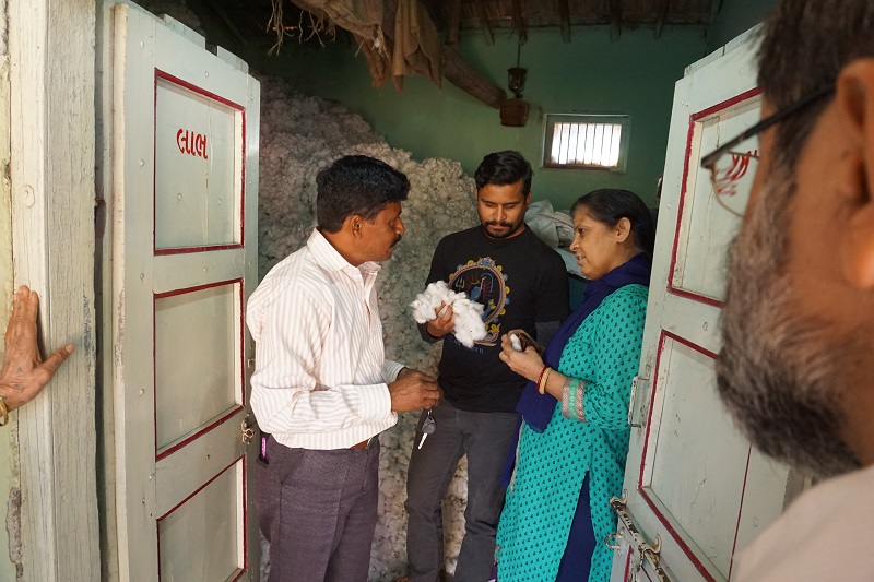
Jaisukhbhai picked fresh lemons from the backyard, showed us the kitchen with neatly stacked steel plates and a storage room full of virgin cotton. We had never seen so much cotton from a farm. Jaisukhbhai explained that in older times the storage room used to be full of mangoes from the family farm. Oh how we wish we had come back then!
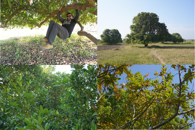
Driving through the village, we realised how clean and developed the villages in Gujarat are. The entire village had concreted roads and rubbish bins something that is unheard of in India. Finally, we reached the family farm which was once an orchard. The buffaloes, cows, mango, chikoo & guava trees and a well. It was a highlight of the trip when we jumped on a mango tree and took photos.
Beautiful Coast
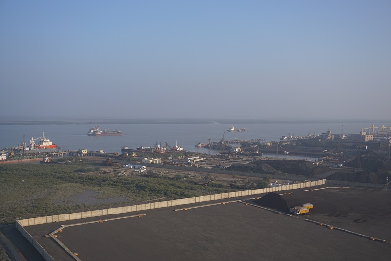
The terrorist attack in Mumbai in 2008 was initiated by terrorists who entered the city by boat. This prompted the Indian Government to make the coast secure. We visited the radar systems on a family visit to see how the government keeps a track of the ships that come in.
Other than this, we were also able to visit a ship with chemicals as cargo. The size of the ship was magnificent. The deck of the ship and the engine room certainly had me impressed as it was the first time I had been inside a ship. It was an engineering marvel though I am no engineering fan.
Finally, our tryst with the coast had its pinnacle when we lived next to a light house for a night near Dwarka. It was no moon night and with our not-so-good-camera, we tried to capture the stars (those white tiny dots).
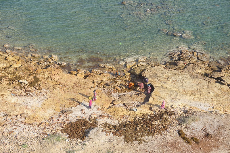
The coast of Saurashtra has several lighthouses and we were lucky enough to get a view from the top. While we were on a holiday, we saw how tough life can be even in the most beautiful places. Women from the cattle herding caste were pulling out seaweed from the water to dry and feed their cattle.
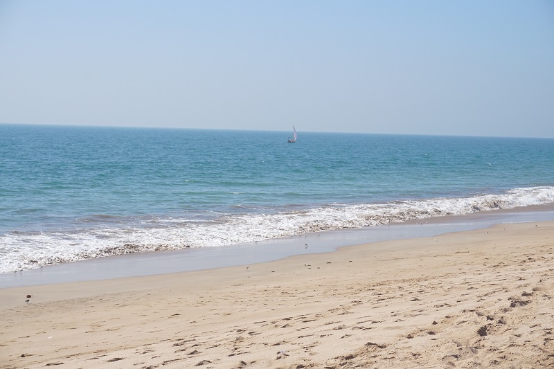
We also stopped at a stretch of road which had a beautiful beach adjacent to it. The beach was clean, the water was cool and the sand was fine. I never thought I’ll be seeing a beach in Gujarat, let alone a pretty one. Having said that, people were not recommended to swim in it due to very strong currents.
Industrial visit
There’s not a lot for unemployed travelers to do in Gandhidham. That can only be a good thing as the city is full of industry especially transportation, shipping, cement and salt. Having said that, it left us bored and looking for things to do.
Seeing our boredom, my father-in-law sent us on a industrial visit. Initially, I wasn’t too keen on it as I couldn’t see a point of seeing machines and that we were swapping one boredom for another. How wrong I was!
We were met by the Head of Security of the fertilizer factory plant at the gate. We put on our construction place hats, face masks and boarded the jeep. On our way, we saw large mounds of ammonia which is one of the base products. Once inside, we saw the huge machines and the computer systems controlling the machines and their output.
Later on, we moved onto the ammonia storage tanks. The temperature is kept at minus 30 and the ammonia is received directly from the ships that dock at port. This combined with the chemical ship completed our tour of two industries of Kandla/Gandhidham. It may not have been the factory or the ship so much but we were awed by the industrial scale in Gujarat.
Invisible lions
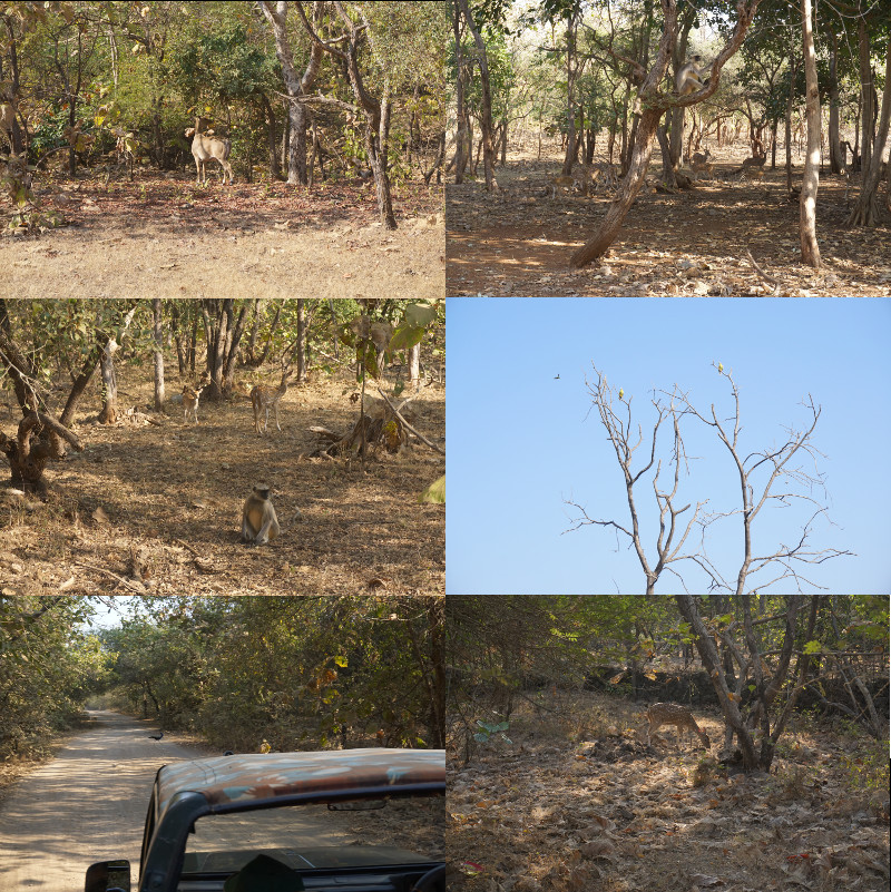
Gujarat is the last home of Asiatic Lions in the world. We had an opportunity to visit the Gir forest which is spread across four districts of Saurashtra. Our safari was at 9am and we were excited to see a Lion roar.
Tip: Don’t forget to book your permit online here. There are limited number of safaris everyday and the officials are very strict about the number of people visiting the forest.
The driver and guide however were not so optimistic. Lions are extremely lazy and they rest for up to 20 hours a day. Their most active times are dawn and dusk. Unfortunately, having no prior experience we had picked the 9am – 12pm slot.
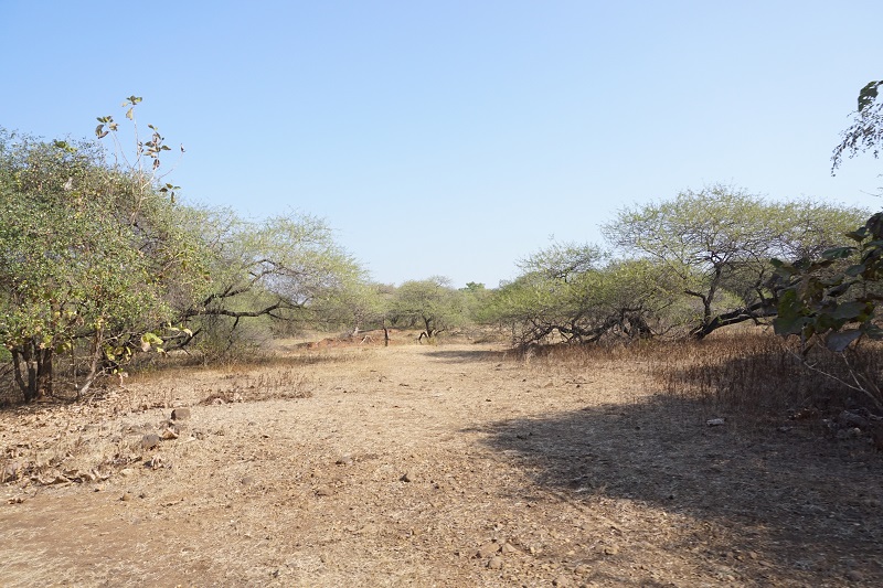
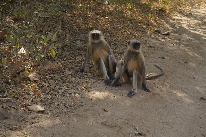
As soon as we got into the jeep, we had picked out directions to spot the lions. The guide was sometimes out of the jeep to view the tracks left by the lion. The forest itself was amazing. Lions live in dry forests or savannah. The dry forest provides the lion with enough cover and open areas to hunt.
We tried several routes, saw deer and blue bulls but no lion. Unfortunately, the jeep can only go on marked tracks and the lions only come out there in the mornings and evenings. During our time, they were somewhere deep in the forest. The guide made us feel better by telling us stories of Amitabh Bachchan and Shankarsinh Vaghela, former Chief Minister, who had to try for several days before seeing a lion.
Personally, it was not such a disappointment though. We learnt a good lesson this time in terms of wildlife. India has several national parks with big cats, rhinos, elephants and other exotic animals. Due to the strong Indian sun, most of them come out only at dawn, dusk and night. We will take better care next time!
But for now, see this picture:
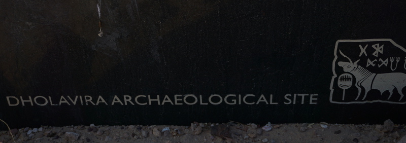
Dholavira
Indus Valley Civilization is the ancient civilization of India. It existed from 3000 B.C. and helped created the modern Indian civilization as well as had a significant effect on Pakistan. Most excavated sites of this civilization were found between Indus river and the Thar desert, most of which now lies in Pakistan.
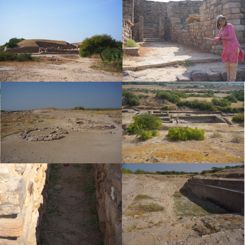
Gujarat has several sites relating to this civilization. For us, the closest was Dholavira situated on an island in the Great Rann of Kutch. The drive took around 3-3.5 hours, half an hour too long because I was learning the manual transmission driving.
Once we reached there, the ruins were on one side and the museum on the other. As we walked up to the museum, the guard asked us to see the ruins first and if we wanted a guide. We declined and were left alone. The ruins were huge with the royal area, middle area, lower area, 2 stadiums and 2 rock cut reservoirs.
The build of the walls was so strong that they survived thousands of years before being excavated. Nothing is known about the language of the harrapan civilization and why it dissapeared. However, it was a civilization on par with the greatest civilization in the world for its time.
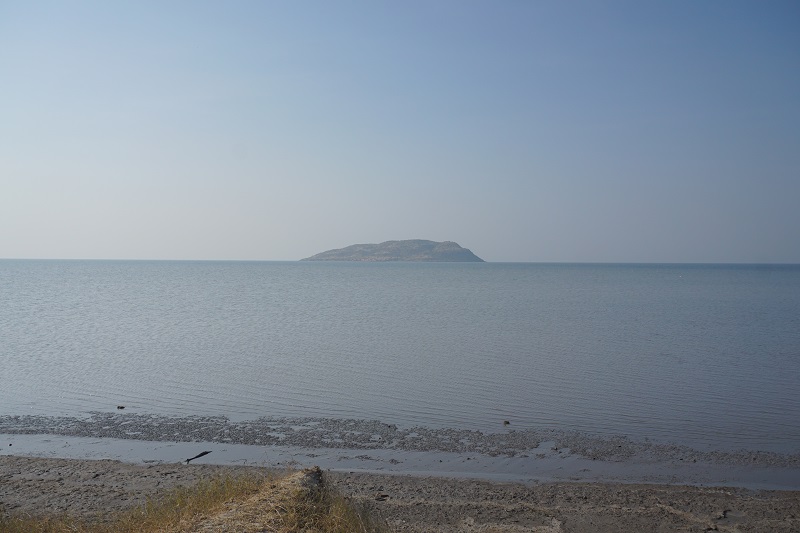
Great Rann of Kutch
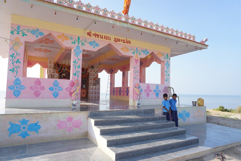
Dholavira is situated on an island which is in the middle of a huge salty lake which fills up during the monsoon and then starts drying up leaving a layer of salt layer which is only found in a few places in the world. We were able to see the Great Rann of Kutch lake which resembled an inland sea complete with several islands and sea birds in it. The lake had a temple and a BSF check post near it. It was really close to Pakistan, basically on the other side of the lake. A perfect location for a photo shoot. As it happened some Hindu religious guru turned up there with his entourage just as we were leaving. Strange place for a prayer though!
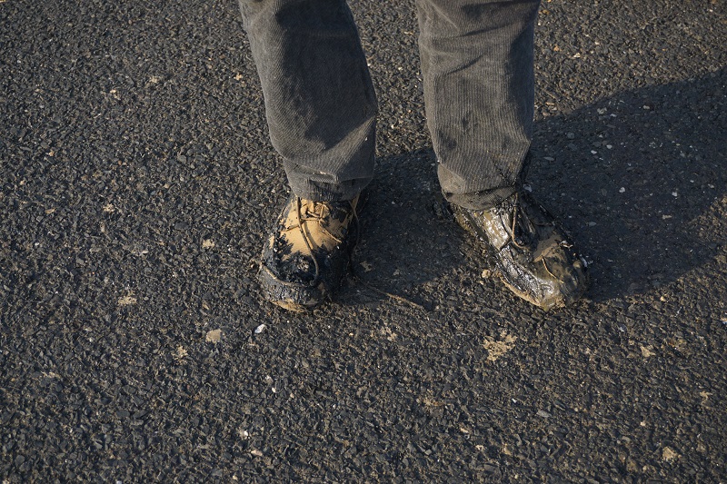
We couldn’t leave without trying a few perspective shots in the salt pan. We stopped the car on the causeway and decided to walk down. We found that the salt was on the surface but underneath it was still muddy but strong enough to support our weight. We should have left it there.
However, if we did that we would normal in the head. Therefore, I went to the other side of the causeway to try my luck. At first it appeared to be working but one step forward and both my shoes were in mud. I pulled out as quickly as possible while Shruti and the driver stood on the causeway laughing. I walked back like a batsman who got out on a duck, folded up my pants, put the shoes in a bag and told the driver to drive home with an angry face.
Little Rann of Kutch
When we were looking at the map of Gujarat, we saw a green area at the edge of Kutch named the ‘Wild Ass Sanctuary’. The name itself made us want to explore it. Shruti and her dad were in conversations with a few tour guides for it.
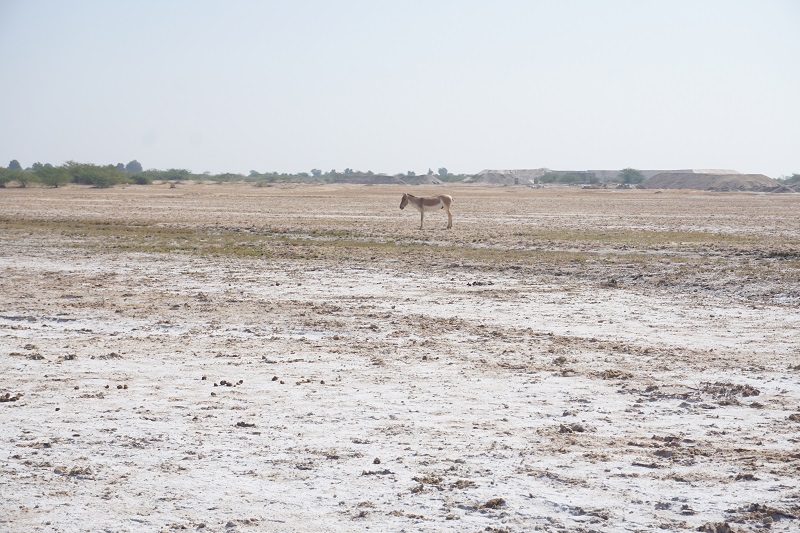
In the end, we selected eco camp at Jogad with two safaris. Once we arrived at the camp, we realized it was right in front of a huge field where some animals were walking. As we looked closer, we realized that it was the beginning of the Little Rann of Kutch and those animals were wild asses :)
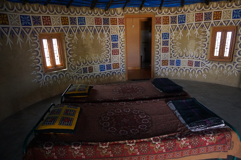
The camp was an amazing spot in open. Traditional mud huts with paintings and basic needs. We loved it!
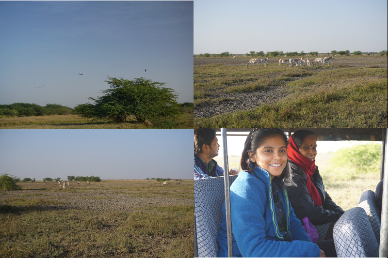
After we checked in, we grabbed quick lunch and napped for 30 mins below heading out in the safari jeep. The field was actually part of the rann where the water in the monsoon moved through. There were grasslands, small trees and lots of animals. Donkeys, blue bulls, black bucks and foxes are quite common in the area. In addition, we saw a few migratory birds and eagles scanning the grasslands for their next prey.
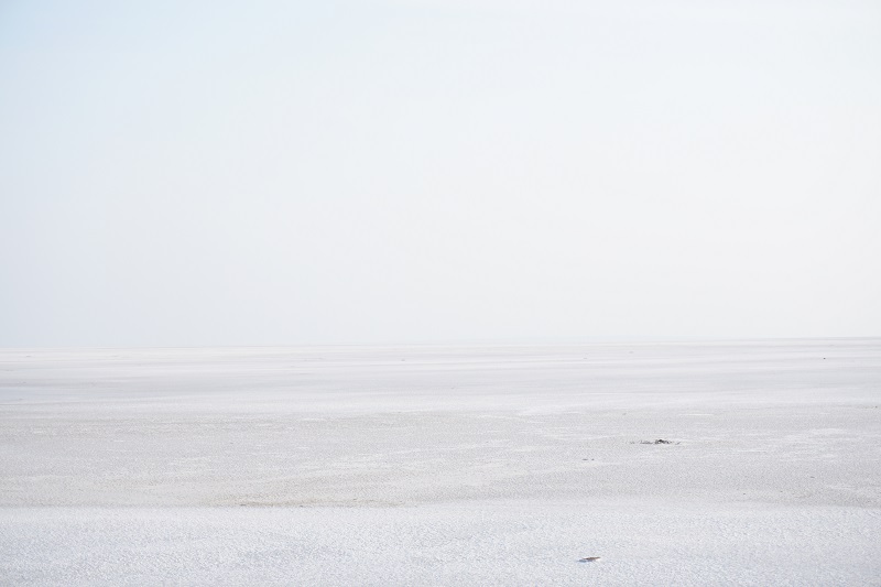
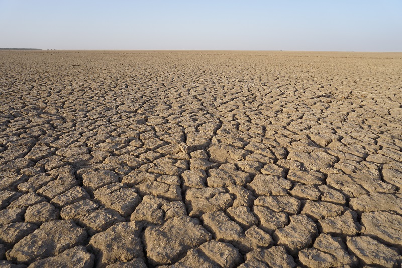
Next, we moved to a unique landscape. Further in the rann, the water fills up during the monsoon from the great rann of kutch and then slowly dries up. However, despite this, the land is parched and cracked due to the brackish water. The land is a desert with no trees, no birds once it dries, no grass, no people and no sound as far as anyone can see.
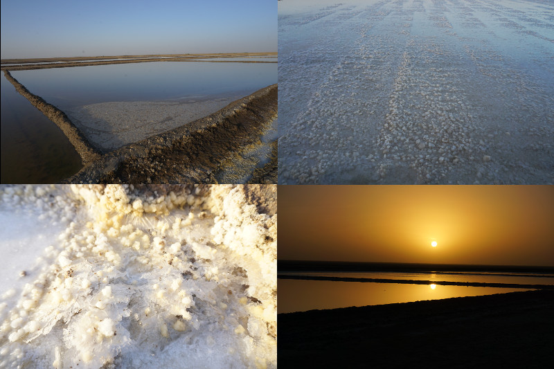
In addition, we then saw the salt making areas within this desert. Pools of water were stored next to each other. However, our guide, Mr. Devjibhai, explained that the pools were connected and the heavy (salt heavy) water moves to the end and crystalizes. It was beautiful to be there at sunset.
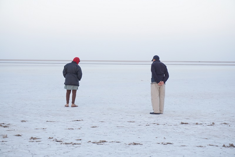
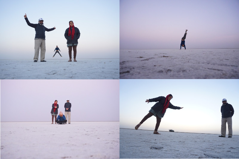
Finally, we were able to see what we had wanted all along. We saw the white desert in the Little Rann of Kutch and walked on it! Our guide drove us to it after driving through dusty mud flat desert and we couldn’t believe that we were walking on a salt pan. In fact, it was the surprise which made it so much better. We had given up on walking on salt pans in India as they were not dry enough (read my accident above).
Initially, the in laws were a bit concerned about walking on the salt pan as it was still muddy in places. However, seeing our enthusiasm, they also got into the photos and enjoying the rann. Somehow late but it was one of the best experiences that we had in India.
Though we were tired, we spent half an hour star gazing and the sky at this place was amazing. We walked a little away from the camp and gosh the stars were everywhere. Our guide told us that they do star gazing expeditions for western tourists which generally involves giving the tourists a bed, some warm clothes and leaving then out there for the night. Scary and beautiful at the same time!
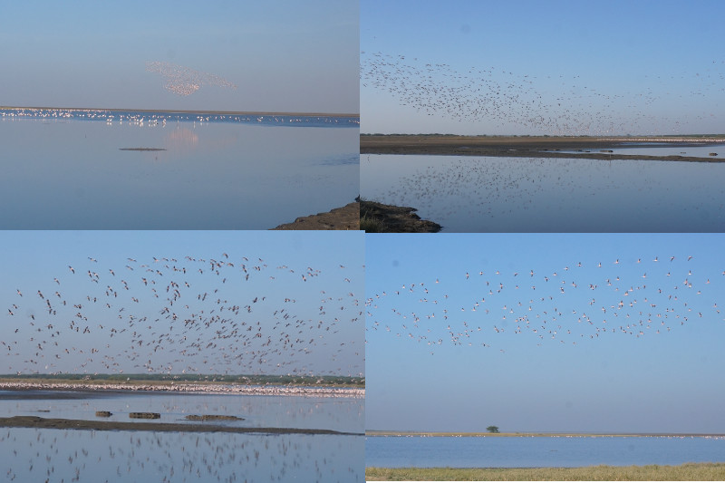
The next morning, we had another safari to see flamingos. We all got up very early and got in the jeep. However, none of us had imagined how cold it would be and to be honest, I was shivering because I thought one sweater works be enough. In addition, we had to drive 50 kms through villages and farms which left us coughing due to the dust.
The end result however was magical. Once we arrived at the wetlands of the little rann of kutch, we could not believe our eyes. There were hundreds of flamingoes flying around and thousands sitting in the lake. The blue lake, blue sky and the pink flamingos made the sight picture perfect.
Here is a short video (sorry about my thumb) –
We walked closer to the lake carefully and observed the birds closely with a binocular. Our guide told us that all the birds were migratory and after monsoons hundreds of thousands come for nesting. We even saw some pelicans and seagulls. It was almost unbelievable that this is a yearly event.
Staying with parents
It was kind of unrelated to our travel but Shruti wanted to spend some time with her parents. However, the fact that we were able to combine our time with the parents with a little travel around Gujarat made it perfect.
In addition, not only did we recharge our batteries but even I got to spend time with the in laws. It was a great time listening to the shipping stories of father-in-law while enjoying mother-in-law’s cooking and views on everything from the present generation, financial investments and mostly Indian politics.
Finally, it was good to see our relationship change from a formal one to one like parents and kids.
P.S. – Shruti’s mum was bang on about Gandhidham’s food being terrible.
Summary
Final thoughts
What to say about Gujarat? Firstly, Gujarat was never one area. Saurashtra, Junagadh and Kutch were always different to Ahmedabad and surrounding areas. This difference was obvious in our road trip. Kutch is mostly dry and industrial while Saurashtra was fertile and traditional. From our small time in Ahmedabad, it resembled Delhi. The buildings, roads, bridges and the riverfront made it look like a well developed city.
Whatever be the history, today Gujarat has developed tremendously while still keeping its culture and traditions alive. Providing good highways, Gujarat has made its religious and natural sites into a tourist hub.
While it may have had instances of sectarian violence in the past, everything now seems peaceful mainly due to having jobs and industry. It’s pretty hard for working people to be rioting with each other and its also economically bad for all communities.
While people may claim that Gujarati food is sweet and inedible, we found this statement to be false. All through our road trip, we found gujarati food to be spicy and different especially the breads of millet and sorghum.
In all, we were glad we spent time in Gujarat. Amitabh Bachchan is right in both his sayings “kuch din to guzairye Gujarat mein”(Try and spend some time in Gujarat) and “Kutch nahi dekha to kuch nahi dekha”(If you didn’t see Kutch, you didn’t see anything). While these lines may have been created to rhyme in Hindi, they are essentially right. Even we recommend staying in Gujarat and seeing the place while you should not miss out on Kutch. Many places in the world gave mountains and deserts but the salt pans and animal safaris together in one area are rare in the world. Do check it out!
The only negatives to the entire trip are that there is no alcohol in Gujarat officially and that the accommodation at tourist spots is not cheap. Firstly, I say officially because there is plenty of alcohol and deaths from alcohol but the government banned it due to Mahatama Gandhi’s beliefs. It didn’t work and there is plenty of corruption over it. Secondly, this may only apply to natural sights as they are either far from cities or are extremely popular. You get what you pay for!
Accommodation
We stayed mostly at home but when on the road we stayed in hotels and government guest houses.
Meghalaya is a state in India’s Northeast on the border with Bangladesh. It is famous for its rains, tribal culture, rock bands and amazing flora and fauna.
We travelled to Meghalaya in the same tour as mentioned in previous posts. Since our last destination, Darjeeling and Shillong, Capital of Meghalaya, are separated by hundreds of kilometers, train was our best option. We arrived in Guwahati, an Assam city, to meet our driver, who then drove us to Shillong. Meghalaya border is only 18 km from Guwahati while Shillong is 90 km. Getting there by road from Guwahati was the best option.
Umiam Lake
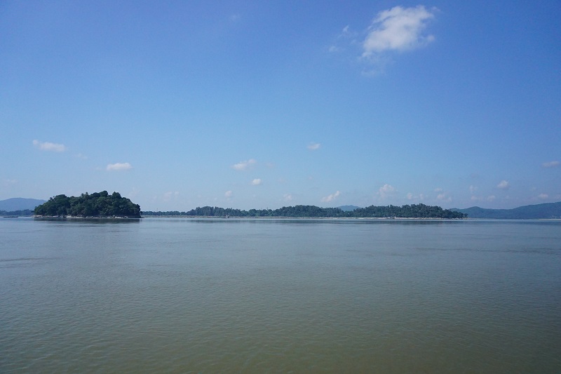
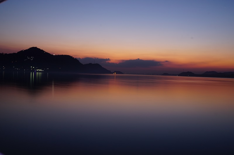
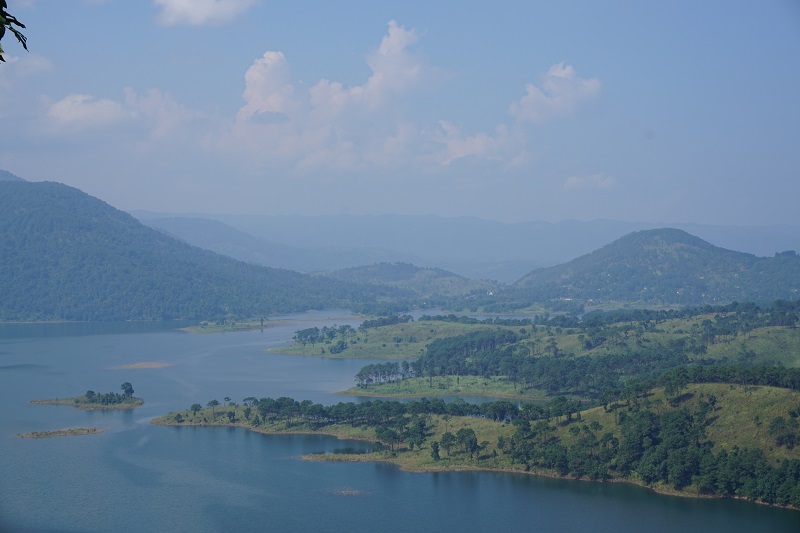
Since we arrived very early in Shillong, we had lots of time before check in. The driver took us to Umiam lake to kill some time. As we neared the lake, we couldn’t believe our eyes. The lake was beautiful beyond belief, the deep blue color against the green hills. It was one of the cleanest and untouched lakes that we have seen in India.
Sightseeing in Shillong
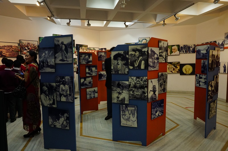
As part of the tour, we did some sightseeing in Shillong. We visited the Don Bosco Cultural Museum where we spent a couple of hours. The museum gave information about the North East Region, it’s geography, it’s people and cultures. The information on the tribes of the North East Region was invaluable and we were thankful for so much information. We were especially glad to have the information about the Khasi Tribe which is predominant in Shillong, Cherapunjee and Mawlynnong areas. Moreover, The view from the roof top gallery was also amazing as it gave the full view of the Shillong valley.
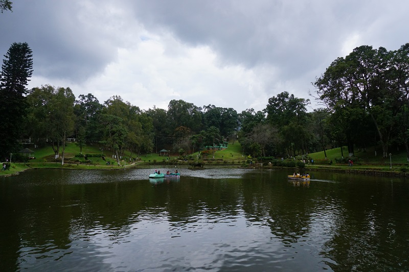
We then proceeded to Wards Lake which was a small and pretty man-made lake. As we bought tickets for entry, we pondered whether we skip this lake as no matter how pretty it was, it couldn’t match the beauty of Umiam Lake. However, we had just ordered our coffee and some snacks at the lake cafe when the heavens opened up. The rain came pouring in as the clouds thundered above. Not listening to our guts meant that we had to wait it out. After 45 mins, we had enough and joined some of the cafe workers who were running out under a picnic umbrella, yes picnic umbrella!
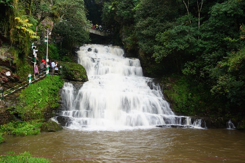
We continued our tour the next day and saw the Elephant Falls and the Shillong Peak. Both of these are must dos in Shillong and you will not be disappointed. The falls are huge and one gets to understand the huge amount of water coming down the hills of Shillong.
The peak is also a magnificent and gives the full view of Shillong city.
Damaged Hills
The rest of our days in Meghalaya involved day trips around the Khasi hills. These hills are old mountains very similar to the Blue Mountains in Sydney. They are small, green and contain rain forests. One of the first things we noticed was the destruction of the hills and hill tops for extracting building material.
While one can understand the need to extract building material, the scale of the destruction was immense. The entire stretch between Shillong, Cherrapunjee and Mawlynnong had damaged hills. We only hope this will change in the future.
Cherrapunjee
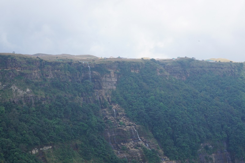
Cherrapunjee is a well known town in India for being the wettest place, not just in India but also the world, or at least it used to be. No trip to Meghalaya is complete without a visit to Cherrapunjee. The landscape of the area is so beautiful that while at the top of the hill, it feels like the rolling hills of Scotland or New Zealand while down in the valleys, one could be in Australian rain forests.
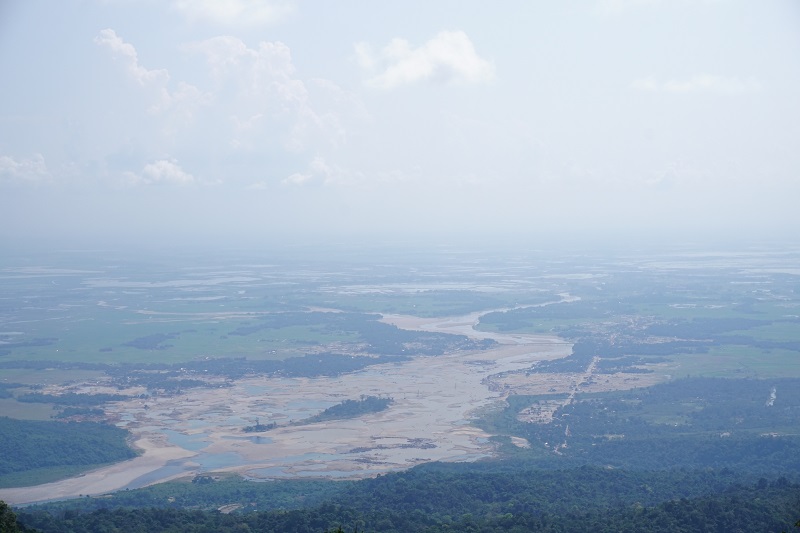
One of the most amazing sites in the area was seeing the plains of Bangladesh. When the subcontinent was partitioned, the Garo and Khasi hills went to India while the plains of Slyhet went to East Pakistan which eventually became Bangladesh. All the rivers of Meghalaya drain in Bangladesh so all one can see are lakes and fields. A beautiful sight!
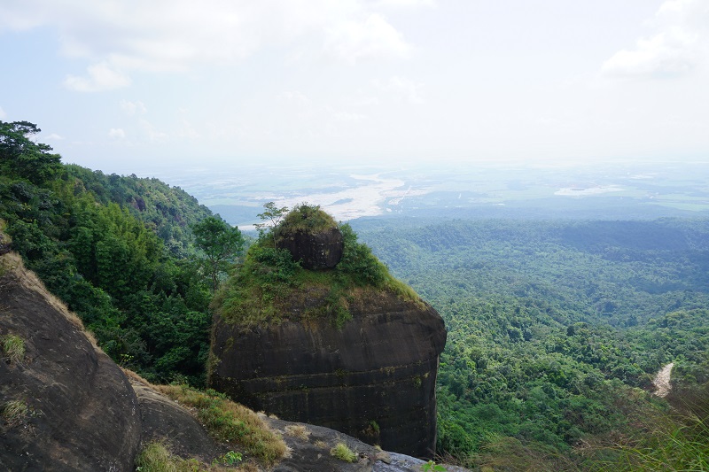
Another beautiful sight in the area was the upturned basket rock, traditionally called Khoh Ramhah. It was a cylindrical shaped black rock in the hills overlooking the Bangladesh plains. There was a waterfall in the vicinity but we decided to climb down to another waterfall in the area.
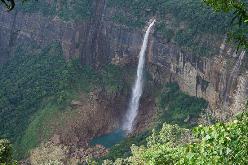
Finally, we saw more waterfalls and hills in the area. However, the most amazing was the Noakhilikai Falls where the falls dropped into a blue pond. We couldn’t help but thinking that we were close to home in the Blue Mountains.
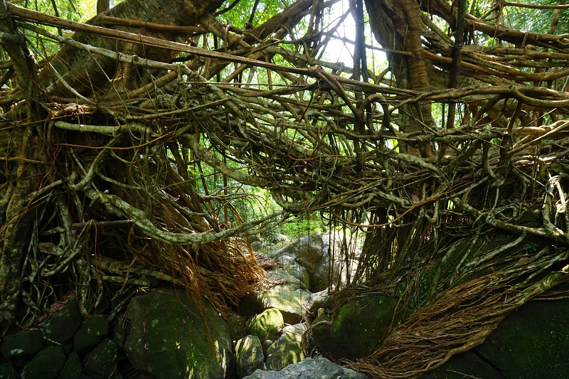
Root Bridges
The Khasi Tribesmen had been using root bridges for centuries to cross waterfalls. They guide the roots of banyan trees using bamboo but eventually remove them as the roots grow thick over the years. Some of the bridges are 100s years old and can carry the weight of over 50 people.
On the way to Mawlynnong
Mawlynnong is a village in the East Khasi Hills some distance away from Shillong which has been dubbed as Asia’s cleanest village. As part of the tour, we got to visit it and the surrounding villages.
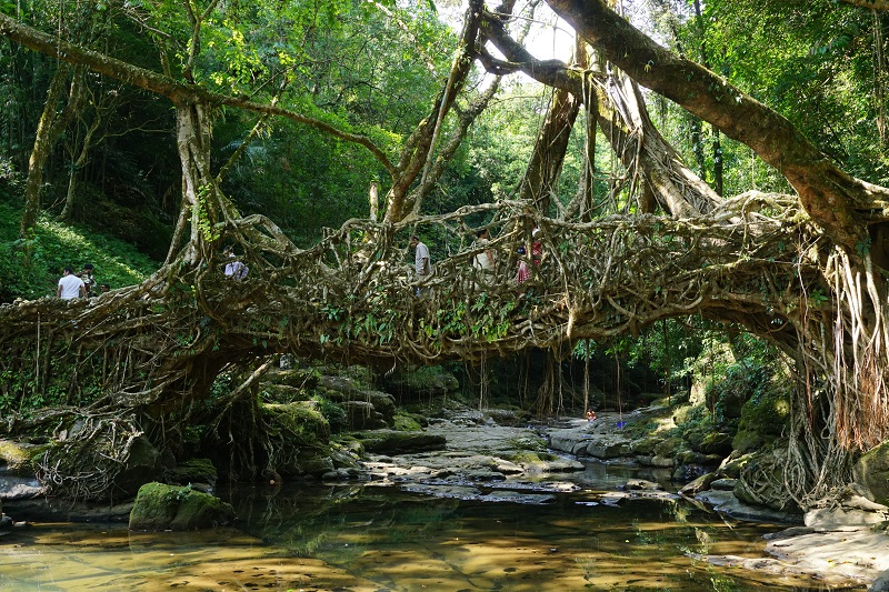
On the way, we stopped at another living root bridge at the Riwai Village. It was the biggest root bridge we had seen and it was almost a 100 years old. Interestingly, the original designers did not get to walk on the bridge itself. While the bridge was full of tourists, the locals were busy washing their clothes on the river. We couldn’t help but think that while the tourists enjoyed themselves on their property, life was as tough for the locals as it was a 100 years ago.
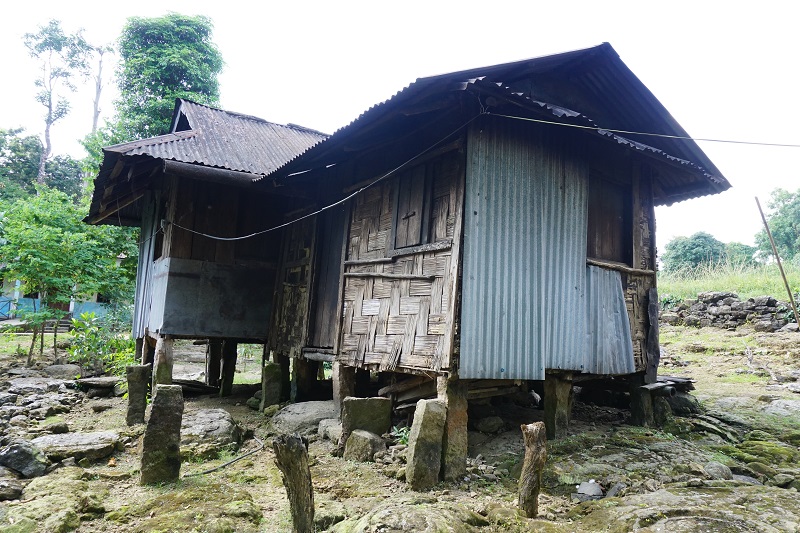
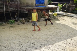
We decided to walk a little further to the Nowet Lookout. As it happened, the lookout was on the other side of the village and we got to watch the village life go by. There were kids playing, chickens running around the village as well as other animals like dogs and pigs. The houses had traditional thatch roofs with bamboo for walls and support. Modernity had reached the houses as some houses had dish TV and a few houses were made of brick.
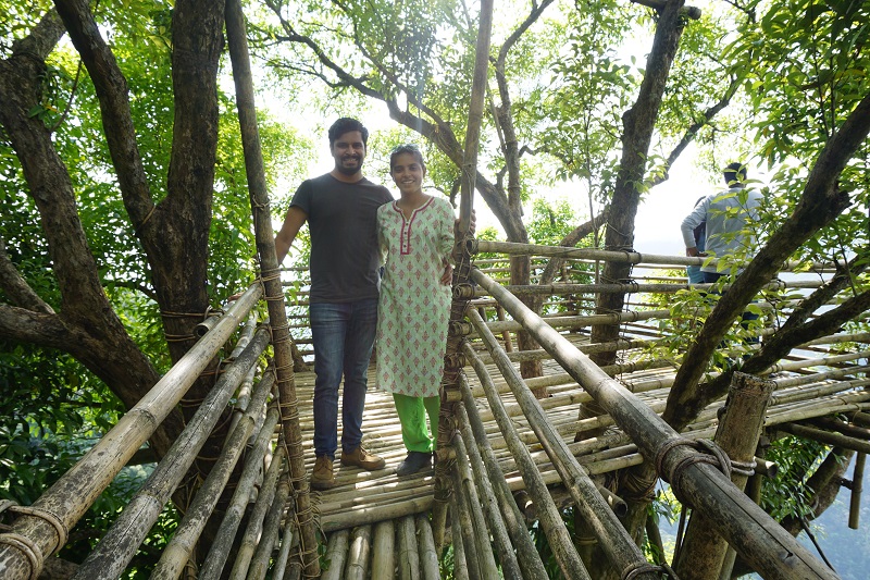
We had imagined the lookout to be a concrete platform built by the Government as is common for the area. However, upon getting to the lookout, we realised that it was a village owned lookout made by a handful of people. The lookout was completely natural made of bamboo, tired with natural rope and supported by a tree on the side of the mountain. It probably would not pass a safety test in Australia but it was one of the best lookouts we have seen. The view was also magnificient as the Riwai river came down the hills on its way to Bangladesh.
Mawlynnong itself was a tiny little village atop a hill with a view of the plains. It was certainly clean and beautiful but nothing too interesting to write about. It seems someone had created Mawlynnong as a tourist destination with the surrounding villages as stop off points. We had a traditional lunch in the village before heading back.
Guwahati
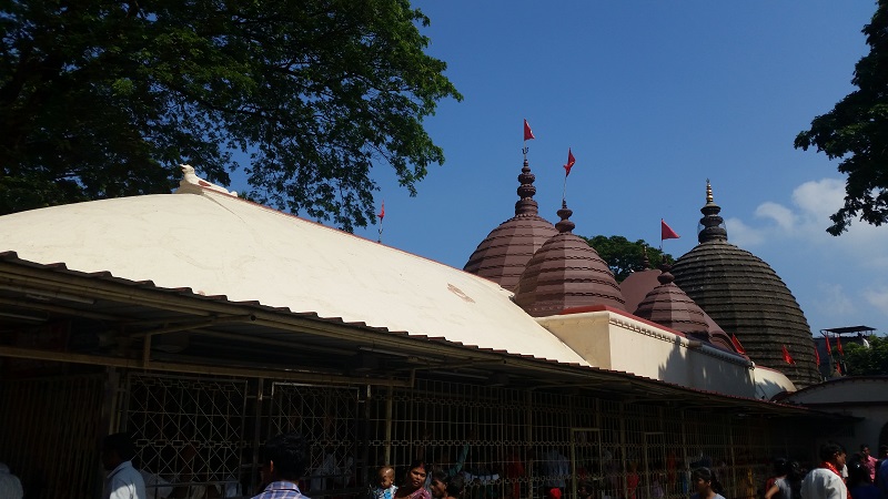
We were in Assam for 1.5 days to see the sights of the city. Our first stop was the famous Kamakhya temple. Being Navratri (nine holy days of the Goddess), the temple was full of people and the line to enter the main temple was several hours long. We decided to take the shorter route from which we could see the idol of the Goddess.
Once done with this, we walked around and saw the animal sacrifice in the vicinity. Animal sacrifice is uncommon in temples nowadays but it is a common ritual during Navratri. Though we don’t do it ourselves, it is an accepted part of Shakta and Tribal Cultures in the area. The temple is famous throughout India for its power and healing.
Brahmaputra
Ever since I was little, I had heard about Brahmaputra river. It is the biggest river in India even bigger than the Ganges. There were stories of its might and its mystique as a home to cannibal tribesmen and Hindu tantrik holymen. Therefore, although we could have gone to Kolkata after Shillong, I wanted to see this river and the city.
We got to visit the Umananda Temple which was on an island in the middle of the river. The river though not very fast was constant and its width really was huge.
We had another chance of going to the Brahmaputra on an evening cruise. Boarding the cruise ship, we got to take some nice sunset shots, have a couple of drinks and even danced a little.
This ended our trip in Guwahati as well as the tour of the North East region.
Final Thoughts
Shillong was certainly one of the cleanest places in India that we have been to. There was a traffic problem but overall it was a beautiful city.
Culturally, Shillong was the most different place in India that we visited. The Khasi tribe is completely Christian due to the missionaries from Europe in 18th Century. We never saw any Hindu Temples and most people in the city were tribal. The women would wear a checked or colored cloth around their torso and tied at the shoulder. Eating paan with lime and beatel nut was a common thing in Shillong. Everyone had Red lips from it but unlike the north, no one spat it out.
There was only one problem in Shillong. The internet was very bad in the city. However, this may be due to our operator.
Guwahati was our last stop in the North East. We weren’t expecting beauty like Sikkim or cleanliness like Shillong, though a lot of the highlights were shut.
The tour itself was a major highlight for us. It had taken a couple of months with several tour operators to sort out the details but we finally managed to do it. The tour gave us a little more information on the region and we would definitely be back though may spend more time in Sikkim or further east like Nagaland or Manipur.
We left Gangtok and headed towards Darjeeling, famous for it’s tea. Instead of taking the main highway, we traveled on a village road. The drive was stunning as we saw terrace rice fields in full bloom facing the Teesta river which itself had a deep jade colour. As we were entering the city way past sunset, we saw thousands of stars above us and the lights of Darjeeling all across the mountains. It was a great start!
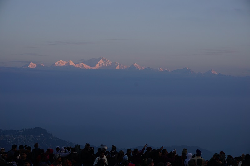
Tiger Hill
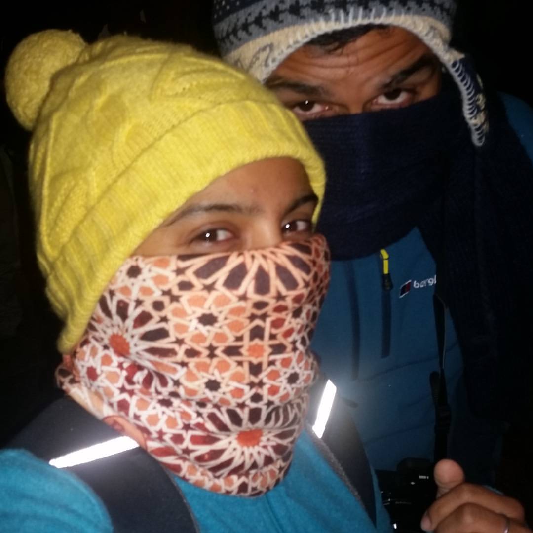
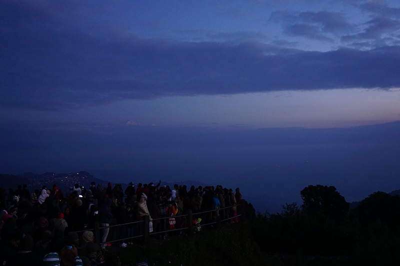
Since it was a clear night, we decided to see the sunrise from Tiger Hill. It lies just outside the city and is must see. The issue though is that the crowd is too big so you need to get there by 4am to get a good spot to see the sunrise.
Therefore, we woke up at 3am and were ready by 3:30am but the driver was nowhere to be seen. He turned up at 3:50am after a wake up call from us and drove crazy to get us to the hill by 4:30am.
Once there, we realised that we hadn’t rugged up enough and it was absolutely freezing. After a couple of coffees and wearing our scarves on our faces, we grabbed a spot on the balcony in the cold. Although we had a expensive ticket, the seats were full by the time we arrived.
Tip: If you don’t want to stand outside in open balcony, we recommend getting to Tiger Hill by 3am. Hopefully then you would get a seat at level 2.
The sunrise time was 5:30am and we were clicking pictures of the sky till 5:15am. The crowd came in by this time and the viewing area was packed like a Mumbai local train. There was tension in the air about the clouds and whether we will see the mountains. At 5:20am, someone shouted “Look! The Mountain”, heads turned to the west, people started whistling and we saw the first rays of the sun hit the Kanchenjunga and other mountains in the Himalayan range.
It was the first time, I had seen something beat the sun and the sky – no one was interested in the sunrise anymore. A faint sun showed up at the horizon and although there were clouds, nothing matter because the white snow covered peaks were now golden. Being sleep deprived and cold was the last thing on our minds and we were glad we decided to see it that first morning.
Darjeeling Sightseeing
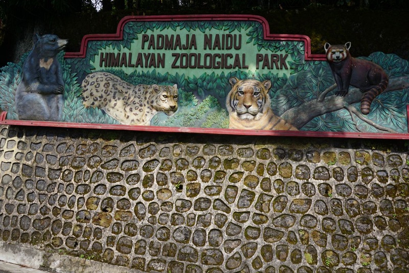
Tours by car run on stop-off point system. Darjeeling has 7 points, i.e, tourist stops. We first visited the Zoo and the Mountaineering Institute. Now, Shruti and I aren’t particularly keen on zoos and parks. We feel that zoos are generally the same everywhere and parks are mostly boring. We would rather walk in a National Park which provides both these things.
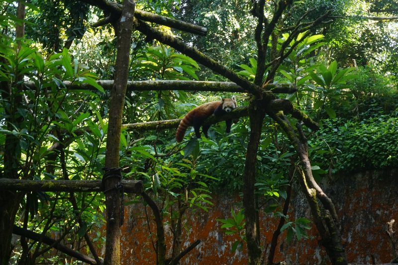
However, the Zoo and the Institute were a combined ticket and the Zoo had Red Panda. If you grew up in India in the early 90s, the ‘Jungle Book’ animation was on TV every Sunday morning. As kids, you just couldn’t miss it. The main character Mowgli had been raised by animals and had friends like wolves, bears and a cute Red Panda. Since then, I had wanted to see a Red Panda. To see one in the wild is tough as they are endangered and live in trees in thick forests.
We finally saw two of them sitting on branches of trees looking rather cute but a bit sad. Once done with getting our panda on, we saw Himalyan birds, bear, deer, sheep, wolves and several cat species. The mountaineering institute was interesting as it showed the history of mountaineering in the Himalayas and several attempts on Mt Everest made by mountaineers from the Institute.
We saw the Tea Garden, Rock Climbing, Japanese Pagoda and Ghoom Monastery before heading back to the hotel. We left some of the flower garden and parks – can’t be bothered!
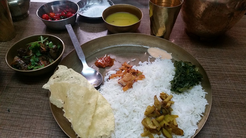
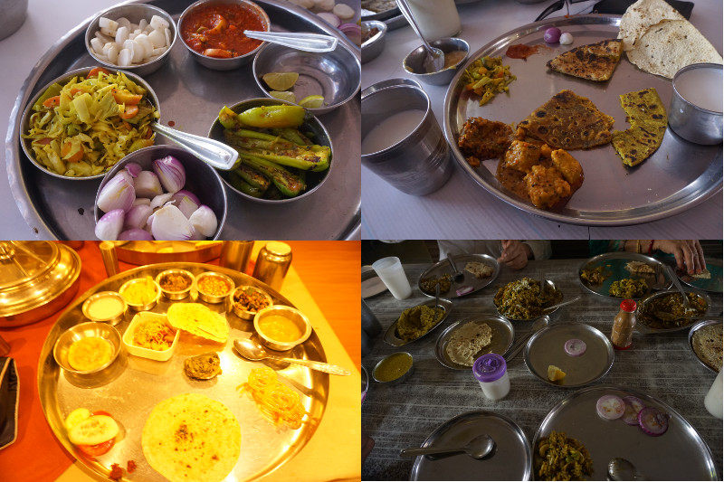
We also had the opportunity to try a traditional Nepali Thali for lunch. The food is served in brazz utensils and a chilli is must. Yum!
Temple of Unity
Mall road is the main shopping area of Darjeeling and we walked around it after lunch one day. We found a sign pointing to a Hindu Temple there and decided to follow the trail up a hill.
Other than the mighty pine trees, we noticed Buddhist Prayer Flag on the trees and temple itself. While we noticed this, we heard temple bells, a sure sign of a Hindu Temple. This left us confused and our confusion increased as we saw prayer wheels outside the main complex.
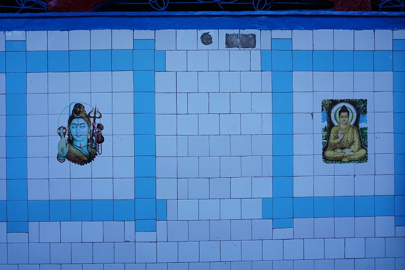
As we took off our shoes, we noticed a trident and 2 deers with a wheel. Both these signs are of Shaivite Hinduism and Vajrayana Buddhism respectively. As we entered, we saw a Hindu priest to the left and a Buddhist monk to the right. We paid our respects and spoke to the Hindu Priest to calm our curiosity. He confirmed that the temple has always been for both religions, perhaps a sign of the mixed Gorkha Nepalese community.
We left quite happy after ringing all the bells and spinning the prayer wheels. Maybe India needs more of these religious places to avoid confrontation.
Please take note Mr Modi!
Reliving the good ol days
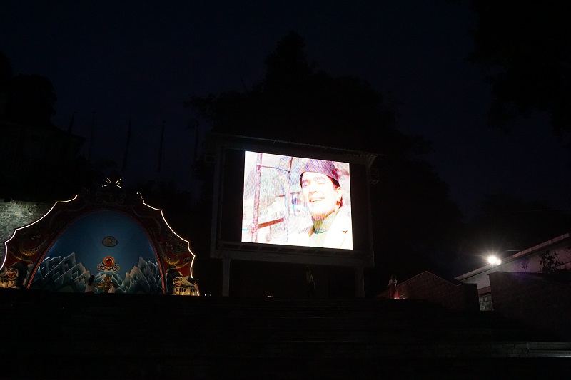
As we finished from the temple, we walked back to Mall Road area and noticed a lot of people looking at a screen. We thought they were watching a film when we noticed it was just songs. It was then that we realised that Darjeeling Govt had put up a screen to show songs that were filmed in Darjeeling. We grabbed a seat, ordered some tea from a hawker and sat watching songs.
We sat watching for over an hour in the cold. Bollywood songs had been shot in Darjeeling for over 40 years and there were a lot of songs to go through. In addition, there were some classics like Mere Sapno Ki Rani which showcases the Famous Darjeeling Train and recent ones like Barfi which anyone seriously into Bollywood will remember.
Mirik & Nepal Border
In the initial research, I had been reluctant to go to Mirik as they was not a lot to do. In addition, at the time we had planned to go to Nepal so going to Nepal border again would be useless. We told the driver in Darjeeling that we didn’t think we had enough to do on the day and he combined a few things within Darjeeling with it. We visited the Batasia loop on the way and it was beautiful.
Once on the road for Mirik, we stopped at Seemana View Point which was a mountainside which divided India and Nepal. The people were Nepalese on both sides but their nationality was different depending on the side of the road which they lived on. We stopped again on the same viewpoint for sunset and we were glad we did. The colours were absolutely amazing and there was a thick cloud drifting through the valley which was a first for us.
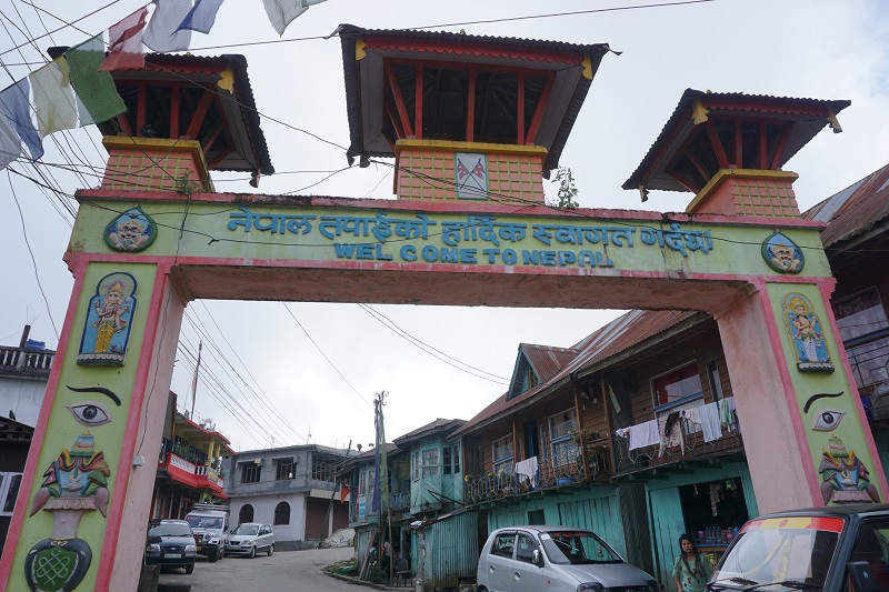
Pashupatinagar is a town on the border of Nepal and India but most famous for the market which is in Nepal. Shruti signed up with her Indian ID and we were able to get in to Nepal without a visa. The market itself had a lot of winter clothes with fashion similar to western countries. Most importantly, we had been looking for winter pants to wear in 0 C and lower weather in Europe or US and we found it in this market. Thankfully, we had enough money for it and grabbed a bargain!
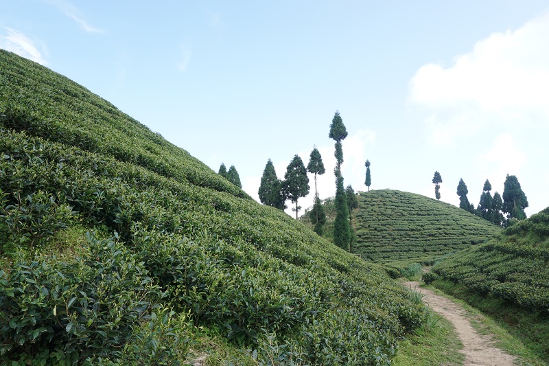
The rest of the journey passed through tea gardens so beautiful that words cannot describe them. Mirik itself is a small town with not a lot to do. We grabbed some Nepalese lunch and walked around Mirik lake. The view across the lake was beautiful and we took lots of photos. At the end, we though the day was a success at least for the shopping.
Summary
Transport
As part of the tour, we had Dheeraj, our driver driving us everywhere. However, taxis are readily available from NJP train station or Bagdogra airport to Darjeeling and within darjeeling itself.
Accommodation
We stayed in Seven Seventeen which was a boutique Tibetan hotel. Staying close to Mall road but far enough to the main road as there is a traffic problem in Darjeeling.
Final thoughts
We had a great time in Darjeeling seeing the main attractions. However, it appeared that the city was a bit dated. Its hayday was probably in the 1980s and it now suffered from traffic problems and fake clothing in the market. However, there are still enough places in the city and nearby to give a great 2-3 days of activities.
As part of traveling around India, we made sure we didn’t miss the North East Region. Based on North Indians, India has been split into three parts – North India, which is up to Goa, South India, everything below Goa and the North East part of India, which brings an exotic feel about it.
We initially wanted to travel around the region by ourselves but as we researched we figured we needed guidance in transport, bookings and places we can visit. So we decided to book a tour that covered Gangtok in Sikkim, Darjeeling in West Bengal, Shillong in Meghalaya and Guwahati in Assam. In a series of 3 posts, we will share our experience of discovering the ‘exotic’ North East Region of India.
This post is all about Sikkim, the do’s, don’ts and what you can’t do!
Crossing the border
Yes, getting into another state in India was almost like crossing the border for Manish. We will give you the dirt in a bit. But first, getting to Gangtok, Sikkim’s Capital.
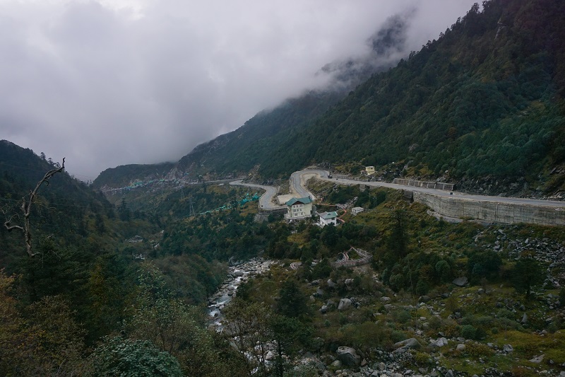
Being a mountainous state, there are no airports. We flew into Bagdogra airport in the neighboring state of West Bengal. The drive to Sikkim was beautiful as we drove around the hills along the Teesta river. The blue of the river contrasted the green of the hills and the light green of the paddy fields making it picture perfect welcome into Sikkim.
So now about the border – Sikkim is a protected state which shares border with China and as I am an Australian Citizen, the Govt. needs to be aware about my presence in their state for my own safety. As such, a foreigner needs to get an ILP (Inner Line Permit) and sign in and out during entry and exit of the state at the border post of Rangpo. It was a strange experience taking a permit for an area within India though I am identified as an Overseas Citizen of India. The experience with the officials was like any other Indian Government Office – slow and tedious, but in the end I got a stamp and entered Sikkim.
TIP: Usually tour operators are aware of this requirement but the drivers may or may not be to alert. If you are non-Indian by citizenship, make sure you stop by Rangpo and get the permit, otherwise it may cause issues while site-seeing. Also, carry photocopy of your passport and Indian Visa otherwise you will be asked to go find one in the middle of new place!
Misty Lake
When we researched into Sikkim, a few places stood out, Gurudongmar Lake, Tsongo Lake, Baba Mandir and Nathula Pass. All these places are up in the mountain range of Himalayas and along the highway to China, which means added border security. Visitors need to get additional permits to visit these places but unfortunately, non-Indians are only allowed up to Tsongo Lake! It was definitely a huge disappointing but we made sure we visit it at least.
Our North East tour operator functions off West Bengal and because Sikkim is so restricted, we got in touch with a local Sikkim tour operator who could help us get permits to Tsongo Lake. But there was a bureaucratic problem – we needed two foreigners to travel together in order to get the permit. For safety reasons, one foreigner and one Indian, which is the case with us, isn’t an ideal match. While we were started to get even more disappointed, our Sikkim tour operator said they will “manage” it. And, trust me, they did!
Tip: When traveling to Sikkim, make sure you book your car and tour package with a local Sikkim operator. Tour operators from other states will have issues arranging visits to places along the border. Additionally, if the car is not registered in Sikkim, they could have unnecessary issues with the police and border personnel.
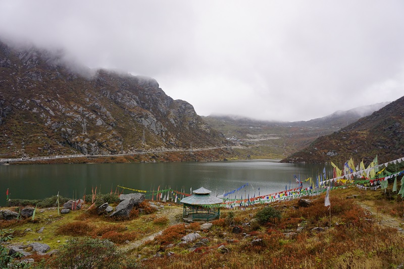
Thanks to Sikkim Travel Info (Tara, Suman and Tara’s husband), we were able to go up to Tsongo Lake which is around 13,000 feet high up in the mountain. There was a lot of Military presence past the check post and we couldn’t help but salute the soldiers as they live in rough weather all year round.
The lake itself was beautiful beyond belief despite the bad weather, fog, in the area. We enjoyed it nevertheless – we have never been so high up in the mountains before!
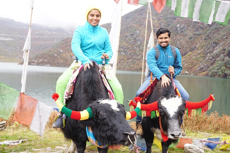
Another highlight for us were the yaks. Yaks are known as the wagon of the Himalayas and are one of the cutest animals. We bargained with the yak herders and rode them around the lake. The animals were sure-footed and very calm but it was scary for us nonetheless. We highly recommend riding them – it is nothing like a camel or elephant ride! We talked to the herders about the training and how they live with the yaks. The yaks start being trained from age 1 and work till 18. The best thing was the decorations on their horns and bodies.
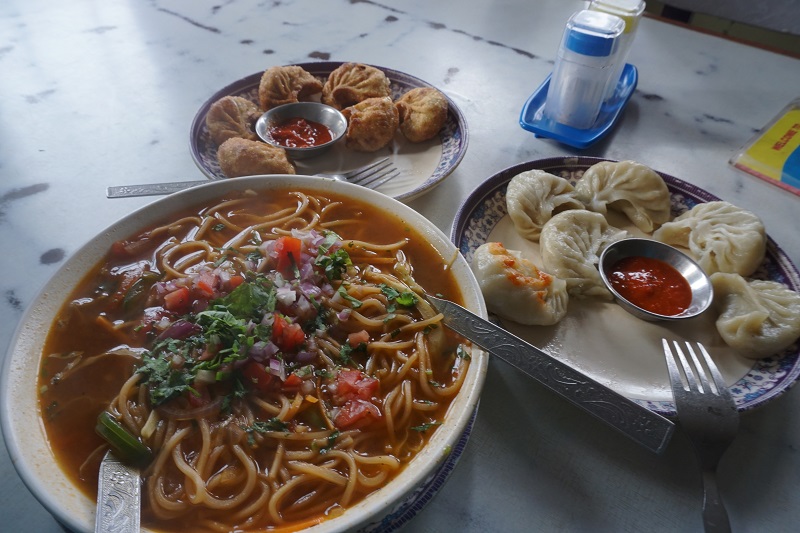
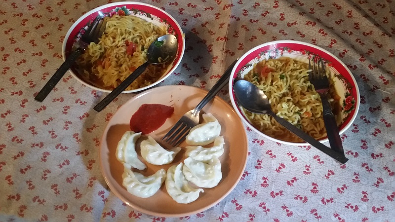
Before heading back down to Gangtok, we decided to have lunch at 13,000 feet. We headed to a tiny shop next to the lake and munched on momos and maggi. Delicious and very satisfying! Do try momos and thukpa while you are in Sikkim – these are the traditional dishes from Tibet.
The Weather
It was already around 10 degrees at the lake, and as we left, the rain came in. The driver was an expert at high mountain driving but we freaked out when the clouds rolled in and the visibility dropped to 2 metres. The driver however couldn’t care less and drove at 50 km/hr along winding roads with a bit of honking. We survived!
Tip: Please bring along a jacket at least. Depending on the month of the year and the altitude you are visiting, the weather may range from 20 C to -15 C. Don’t forget to do your research and gear up accordingly.
A small bite of Gangtok
Though we didn’t have many days to explore Gangtok, we visited quite a few places. Gangtok is a well built city over several levels on the mountain. We visited MG road which is the street shopping mall. One could see the mix of cultures of Gangtok with Tibetan, Nepalese and plain Indians living side by side.
The cleanliness of the city and the traffic etiquette in Gangtok was immaculate. The city was a great tourist destination with pubs, casinos, and restaurants as well as well known sights.
In addition, we had a funny experience related to getting beer. On our first night in Gangtok, we decided to get a local beer. Upon wandering out, we noticed everything was closed so we asked a local young man about a bottle shop. He told us that as it was an election day, the usual bottle shops were closed though he was also looking for a beer and we should follow him.
Next thing we knew, we followed him a few metres down a descending alley, waited outside a house and then followed him through a series of doors into an alcohol storage area. The air was musty, lots of wooden shelves with alcohol everywhere and an old local lady constantly reminding us to stay quite. We bought two beers which Shruti kept in her jacket, paid and were about to run out when we saw a policewoman doing her rounds. Somehow we avoided attention and went to the hotel. The taste of the beer: absolutely criminal!
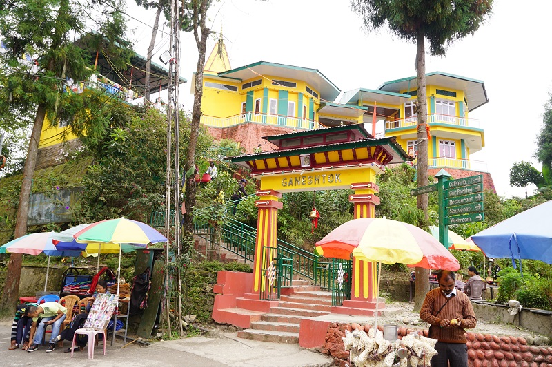
We saw the Gangtok valley from the Hanuman Tok which was the hindu temple of God Hanuman run by the Indian Army. It was awkward seeing an Hindu priest dressed in khaki uniform! We also visited Ganesh Tok – another hindu temple with a great view of the city. Though both these temples were hindu, Tibetan influence to the building and decor was very evident. Everything at the temple was very colourful and prayer flags could be seen everywhere!
Tibetan Buddhist Experience
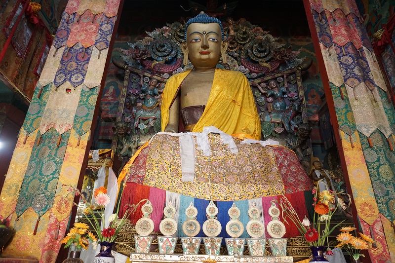
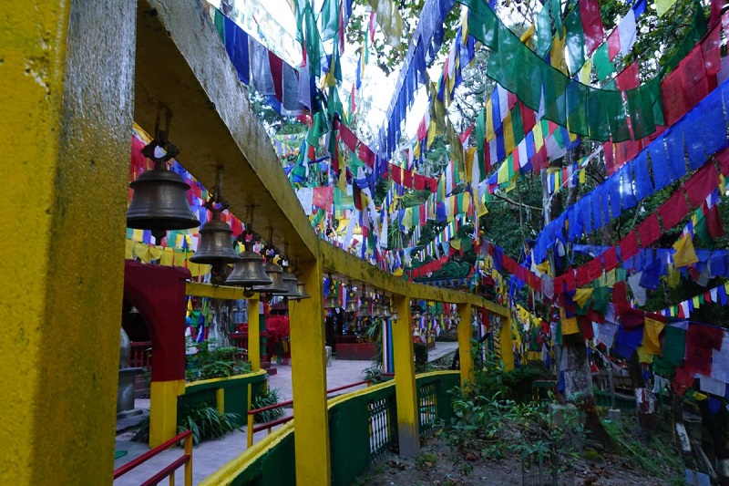
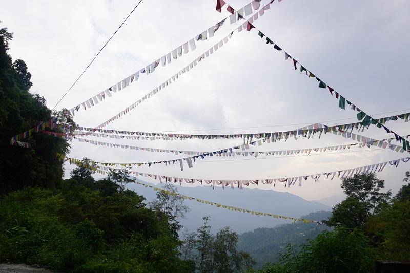
Padmasambhava or Guru Rinpoche, a famous Mahayana Monk and an extremely important personnel for Tibetan Buddhism, visited Sikkim a long time ago. Since then, Sikkim has been an important centre of Tibetan Buddhism or Vajrayana. And as such, throughout Sikkim, prayer flags flew alongside mountains, roads, waterfalls, houses and shops. Shruti absolutely loved them and, I must say, she managed to get LOADS of photographs.
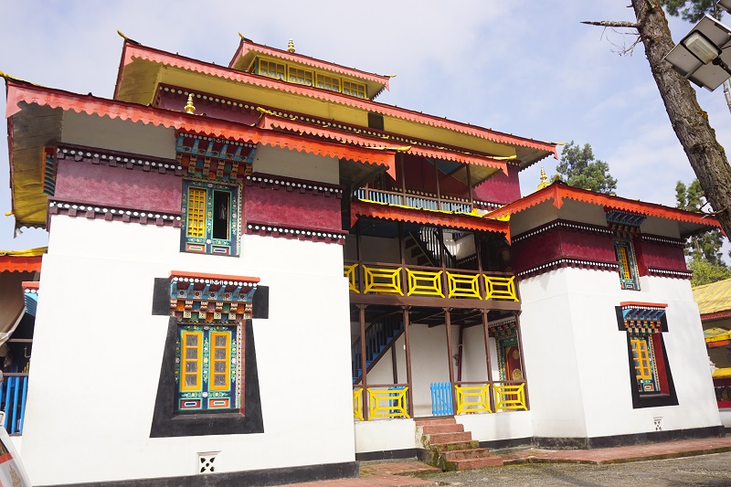
While we were exploring Sikkim, we visited a few key monasteries. At Enchey Monastery, we saw little monks just initiated in the religion as well as senior monks doing their daily practice. Shruti insisted we buy prayer flags, which we took to a monk to bless. It was a spiritual experience as the monk read Tibetan mantras while throwing rice on the flags.
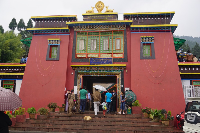
We also visited Rumtek Monastery which is on a mountain opposite the Gangtok city. This monastery was made by the Karmapa who is second only to His Holiness Dalai Lama. There was a big pooja going on at the time and the monastery was jam packed. We saw monks of all ranks and ordinary Sikkimese chanting mantras and doing meditations.
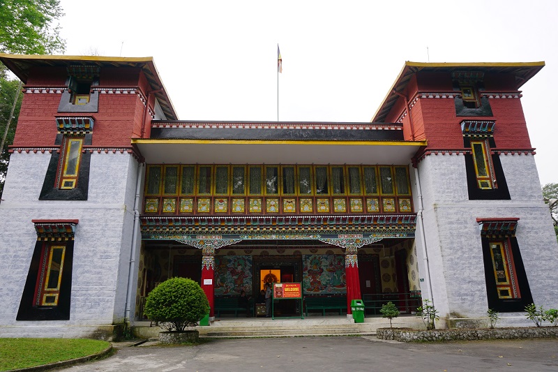
Lastly, we visited the Tibetology Institute which had art, history and the deities of Buddhism as well as the history of Buddhism in Sikkim. We definitely learned a thing or two there about Buddhism.
Summary
Accommodation
We stayed at the White Conch residency which was a decent budget hotel. There are plenty of hotels options of all budgets and home stays in Sikkim.
Transport
As we were part of a tour, we had a driver available the entire day. However, staying near MG road means you don’t need a driver and there are plenty of local taxis available to take you around the city. Having said that, traveling to the tourist spots is easier done with a pre-booked driver.
Final thoughts
Sikkim was truly exotic to us! The people, the food, the culture, the roads and the geography of the place made every second of our trip astonishing and memorable. The place was unique – something we haven’t seen anywhere in India or even overseas. The mix of Tibetans, Nepalese and Indians added to a wonderful mix of culture.
Neither of us had been to Sikkim before and we are sure we will be visiting again. Occasionally, you meet someone who lives his/her job and is very passionate about what they do. We met Suman, the local tour guide you accompanied us to Tsongo Lake, and he inspired us to come back and further explore other aspects of Sikkim. He was so passionate about everything Sikkim has to offer, from the mountains to food to culture, we definitely felt the urge to visit again. And this time, we will be contacting him to plan an outdoor focused trip to Sikkim that may range from treks to camping. Aaah, can’t wait!
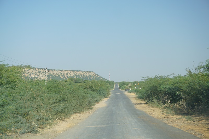
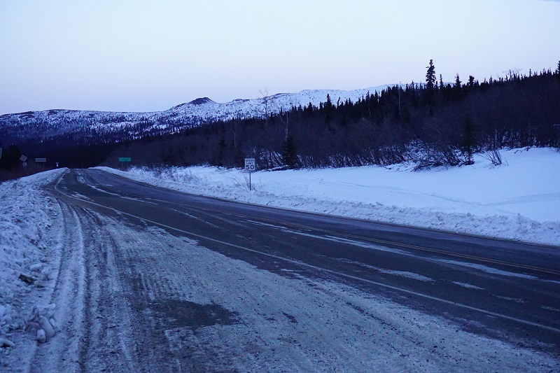 While most of our journey was on the Elliott and Dalton Highways, we rode on mountain roads with very few flat stretches. Along the way, we stopped at Winchester Dome to stretch our legs and take couple of photos. While there, we saw some real mushers training the dogs while their kids helped around. The dogs were cute, the mushers were busy and it was absolutely freezing. We wanted to pat the dogs but decided against it as they are working dogs.
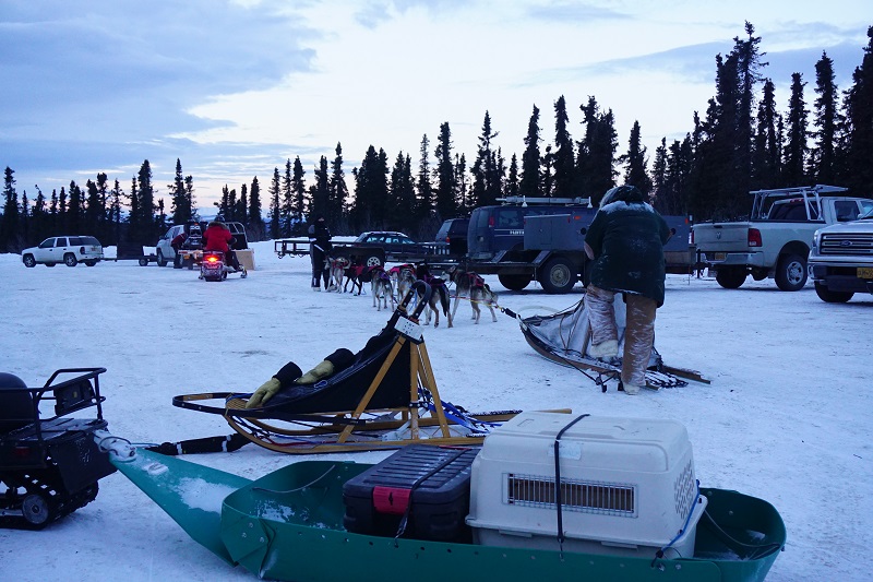
 We decided to walk a little further to the Nowet Lookout. As it happened, the lookout was on the other side of the village and we got to watch the village life go by. There were kids playing, chickens running around the village as well as other animals like dogs and pigs. The houses had traditional thatch roofs with bamboo for walls and support. Modernity had reached the houses as some houses had dish TV and a few houses were made of brick.